The Wild Road to Bald Mountain in Summit County
Bald Mountain is a high mountain peak at an elevation of 3,955m (12,975ft) above sea level, located in Summit County, in the U.S. state of Colorado. It’s one of the highest roads in Colorado.
Where is Bald Mountain?
The peak is located north of Boreas Pass, in the central part of Colorado, within the Arapaho National Forest. Don’t get confused: there are 27 mountains in Colorado bearing the official name “Bald Mountain.” The summit offers some of the best 360-degree views in the state.
Is the road to Bald Mountain in Summit County unpaved?
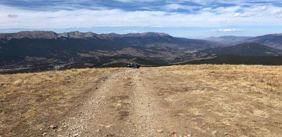
The road to the summit, also known as Baldy Mountain and Mount Baldy, is completely unpaved. It is an old mining trail called Baldy Road (County Road 520). A 4WD vehicle with good ground clearance is required.
How long is the road to Bald Mountain in Summit County?
The road to the summit is very steep, hitting a 23.3% maximum gradient through some of the ramps. Starting at County Road 528, the ascent is 5.63km (3.5 miles) long. Over this distance, the elevation gain is 697 meters, with an average gradient of 12.38%. Near the summit, there’s a solar-powered communications shack. After passing an electrical hut with radio antennas, the road comes to an end.
Is the road to Bald Mountain in Summit County open in winter?
Set high in the Front Range of the Rocky Mountains, the road is usually open only during the summer season. Altitude sickness is a potential danger, as are afternoon thunderstorms. Expect cooler temperatures, strong sun, and wind in this completely exposed environment.
Pic: Brandon Williams