The forbidden road to Salinas Peak in New Mexico: Can you drive it?
Salinas Peak is a high mountain peak at an elevation of 2.730m (8,956ft) above sea level, located in Sierra County, in the US state of New Mexico. There is no public access to this peak nor is photography permitted.
Where is Salinas Peak?
The peak is located in the south-central New Mexico, within the San Andres National Wildlife Refuge/White Sands Missile Range.
Why is there a road to Salinas Peak?
Set high in the San Andres Mountains. at the summit there are radio towers and a heliport. About 20 miles (32 km) to the north lies the Trinity Site, where the first atomic bomb test occurred in 1945.
When was the road to Salinas Peak built?
The road to the summit was built in 1958. It was built by the military to service the telecommunications facilities, radar systems, and missile tracking equipment installed at the top of the peak.
Can I drive to Salinas Peak?
The road and the entire mountain are completely closed to the public. They are located within the restricted boundaries of White Sands Missile Range (WSMR), a United States military testing and weapons facility. There is a military security checkpoint at the base of the mountain. Access is prohibited for civilians without high-level military security clearance. Attempting to bypass the gates or gain access is a federal crime.
Is the road to Salinas Peak unpaved?
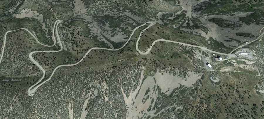
The road to the summit is totally unpaved, with rocks and loose gravel. It’s called Wsmr S Rte 327. It’s very narrow, with steep high-mountain grades and features 18 hairpin turns. 4x4 vehicles only.
How long is the road to Salinas Peak?
Starting from Wsmr P Rte 13, the road to the summit is 8.04km (5.0 miles) long. Over this distance, the elevation gain is 644m (2,113 ft) and the average gradient is 8.00%.