How to drive to North Schell Peak in Nevada?
North Schell Peak is a prominent mountain peak located in White Pine County, in the eastern part of Nevada, USA. Reaching an elevation of 2,775m (9,104ft) above sea level within the Schell Creek Range, the road leading towards the summit offers a rugged journey through a scenic and remote landscape.
| Road facts: North Schell Peak (NF-425) | |
|---|---|
| Location | White Pine County, Nevada (USA) |
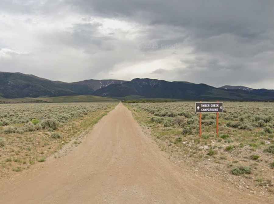
| Road Name | NF-425 / Timber Creek Road |
| Length | 7.88 km (4.9 miles) |
| Elevation Gain | 581 m (1,909 ft) |
| Max Elevation | 2,775 m (9,104 ft) |
| Surface | Gravel / Rocky Dirt |
What is the route to North Schell Peak?
The road to the peak, officially designated as NF-425, starts from White Pine County Road 29, just east of McGill. The track is 7.88 km (4.9 miles) long and runs along the Timber Creek, climbing steadily into the high mountain terrain of eastern Nevada.
Is the road to North Schell Peak paved?
No, the entire route is unpaved. The first section is a washboard dirt road that is generally accessible to most vehicles. However, as you continue through the Timber Creek Campground, the road narrows into a single lane with rocks in the roadbed, requiring moderate clearance and eventually a 4x4 vehicle for the steeper, rockier sections near the end.
How difficult is the driving on NF-425?
The drive involves an elevation gain of 581 meters over a short distance, making the trail quite steep. While the initial miles are manageable, the upper parts of the road can be rocky, tippy, and bumpy. Wet conditions can turn the dirt into a muddy and slippery surface, making driving significantly more difficult even for experienced off-roaders.
Where does the road end?
The drivable portion of the road is blocked off a short distance past the Timber Creek Campground. The track ends at an unmarked trailhead sign, which features two campsites and ample room for parking. From this point at 2,775 meters, the journey continues on foot for those aiming to reach the actual summit of North Schell Peak.
When is the road to North Schell Peak open?
Due to its high elevation, the road is generally open from the end of May through September. Accessibility depends heavily on the winter snowpack and how quickly it melts. During the late autumn and winter months, heavy snow makes the route impassable for motorized vehicles.
Is a 4x4 vehicle required for NF-425?
A 4x4 vehicle is highly recommended if you plan to go beyond the campground area. The combination of steep ramps, loose rocks, and the potential for mud requires high ground clearance and good traction. If you are not comfortable with narrow, unpaved mountain roads and significant heights, it is best to stick to the lower sections of the creek.