How to get to Erickson Mine at the summit of Keystone Mountain in Colorado
Keystone Mountain is a high mountain peak at an elevation of 3,677 m (12,063 ft) above sea level, located in eastern Summit County, in the U.S. state of Colorado. It’s one of the highest roads in Colorado.
Where is Keystone Mountain?
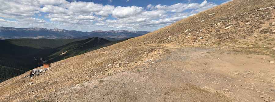
The peak is located west of Glacier Mountain, in the north-central part of Colorado. The summit hosts an abandoned old mine known as Erickson Mine.
When was Erickson Mine built?
The Erickson Mine was first discovered in 1880, during a period when silver prices were bolstered by U.S. government support. When silver values plummeted in the 1890s, operations ceased, and the site was left idle. Over the years, the mine was reopened multiple times in attempts to extract gold instead. Today, the property would require major restoration work: the entrances are buried and unstable, and several structures on the claim have collapsed. Surveyors have noted significant visible gold within the discarded ore piles.
Is the road to Keystone Mountain unpaved?
The road to the summit is totally unpaved and features narrow parts and steep sections. It’s called Keystone Gultch Road. The road is a bit rough and rocky in places, so be prepared, but well worth it if you have a capable 4x4.
How long is the road to Keystone Mountain?
Starting from the paved US-6, south of Dillon, the road is 13.51 km (8.4 miles) long. Over this distance, the elevation gain is 826 m (2,713 ft) and the average gradient is 6.11%.
Is the road to Keystone Mountain open in winter?
Set high in the Front Range of the Rocky Mountains, the road is totally impassable in winter.
Pic: Judah Musick