How to get by car to the summit of Mount Pennell in Utah?
Mount Pennell is a high mountain peak at an elevation of 3,302m (10,833ft) above sea level, located in eastern Garfield County, in the US state of Utah. It's one of the highest roads in Utah.
Where is Mount Pennell?
The peak, formerly known as Un-chu'-ka-ret, is located east of Capitol Reef National Park in the southern part of Utah. Cell service is unreliable.
What’s at the summit of Mount Pennell?
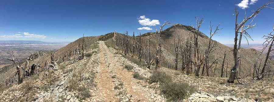
At the summit, there’s a FAA site with communications structures. At this elevation, it’s the second-highest mountain in the Henry Mountains, after Mount Ellen, slightly to the north.
Is the road to Mount Pennell unpaved?
The road to the summit is totally unpaved, and a 4x4 vehicle is required. The road is generally steep, rocky, and narrow. Be prepared for such conditions. Good quality tires are a necessity on the rough and rocky road, as is a vehicle in good condition.
How long is the road to Mount Pennell?
Starting from The Horn Road, the road to the summit is 6 km (3.72 miles) long. Over this distance, the elevation gain is 884 m, and the average gradient is 14.73%. The road may become impassable when wet. Avoid the area during electrical storms and avoid high ridges and exposed areas.
Pic&more info: http://www.girlonahike.com/2016/06/hiking-mt-pennell.html