A steep paved road to Mount Harrison in Idaho
Mount Harrison is a high mountain peak at an elevation of 2.823m (9,261ft) above sea level, located in Cassia County, in the US state of Idaho. It's one of the highest roads of Idaho.
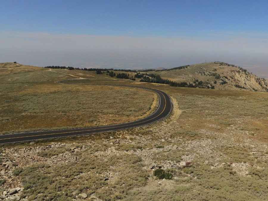
Is the road to Mount Harrison in Idaho paved?
Set high in the northern Albion Mountain range, the road to the summit fully paved. It’s called Forest Road 549 (Howell Canyon Road).
Is the road to Mount Harrison in Idaho open?
Due to its high elevation, the road is closed during winter. The summit typically accumulates significant snowfall, and the road generally reopens after July 1st, depending on weather conditions. Only some sections of the route are prone to avalanche risks, even during severe conditions.
How long is the road to Mount Harrison in Idaho?
Located in south central Idaho, the road is graded and offers scenic views, but it is quite steep. Starting from ID-77 road at 1,707 meters above sea level, the ascent is 11.3 miles (18.1 km) long. The road gains an elevation of 1,116 meters over this distance, with an average gradient of 6.16%, peaking at 10% on some ramps.
What’s on the summit of Mount Harrison?
Mount Harrison is situated within the Sawtooth National Forest. At the summit, there's a lookout originally built in the 1930s and renovated in 1960. Interpretive signs provide information on the area's history and geography. The lookout is open to visitors on summer weekends, offering great views stretching nearly 100 miles of Utah, Nevada, and northern Idaho.
What happened on Mount Harrison on February 9, 1945?
On February 9, 1945, a tragic event occurred when a B-24 Liberator Army Bomber crashed into the mountain amid dense fog. All nine crew members onboard lost their lives in the accident. The wreckage of the plane still remains on the mountain, and in July 2004, a memorial plaque was dedicated to honor the deceased. Besides its historical significance, Mount Harrison features an alpine lake and a glacial cirque.
Road suggested by: Mark Dallon
Pic: Idaho Native