The Ultimate Guide to Traveling the Mineral Bottom Trail in Utah
Mineral Bottom Trail is a very scenic drive located in Grand County, in the US state of Utah. When it's wet, the road can be impassable, especially on the steep switchbacks that descend into the Green river valley on the last part.
Where is Mineral Bottom Trail?
The trail is located in the southeastern part of Utah, in the western United States, just outside Canyonlands National Park, so no permits are required. Mineral Bottom road provides access to the western half of the White Rim Trail inside Canyonlands NP.
How long is Mineral Bottom Trail?
The trail, also known as Horse Thief Trail, is 23.49km (14.6 miles) long. It runs east-west from UT-313 to White Rim Trail.
Can you drive to Mineral Bottom?
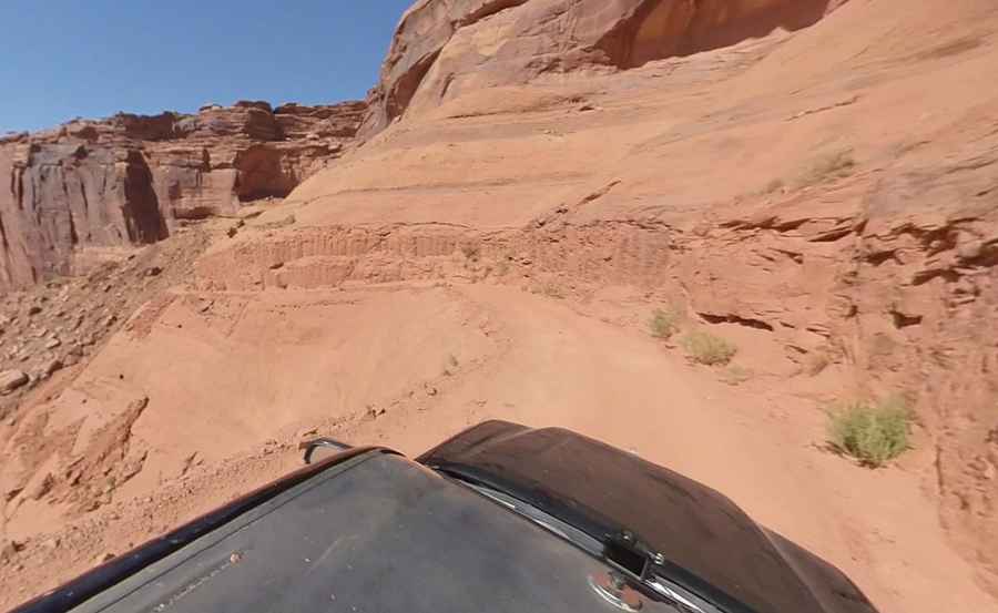
The road, known as BLM129, is totally unpaved. It's a wide county road that drops rapidly to the Green River on spectacular switchbacks to a pleasant drive along the river’s edge. It’s suitable for high-clearance two-wheel-drive vehicles when dry. But driving 4WD is recommended due to uneven surface. Avoid this road if it's wet. If it rains while you’re at the bottom, wait an hour or two until the road dries. Route-finding is extremely easy.
Is Mineral Bottom open?
This track can get very muddy and slippery after rain, making it challenging to get through. When it's wet, the road can be impassable, especially on the switchbacks that descend into the river valley. One of the more dramatic washouts occurred on the Mineral Bottom Road switchbacks on August 19th, 2010, where significant portions of the road were obliterated. This damage caused the closure of the road, affecting anyone attempting to travel the White Rim Road in a loop or planning river trips that launch or take-out at Mineral Bottom. On March 29, 2011, the Mineral Bottom road was open and passable again, making a full White Rim loop possible again.
Is the Mineral Bottom Trail challenging?
The road is not easy, and the shelf parts can be intimidating. It has some steep sections, hitting a 21% maximum gradient through some of the ramps. Though this is a fairly easy trail when dry, it can be very dangerous if the trail is wet. The switchbacks are steep and near the edge, and the road gets slick if it has been raining or snowing. Switchbacks are kind of scary if you fear heights.
When is the best time to drive the Mineral Bottom Trail?
The road can be used all year round. July and August are the hottest months, and afternoon thunderstorms are common during this period. It's best to avoid riding up this road midday in summer. Bring all the water you need. The drive offers a great view of the area and surrounding mountains.
Pic: More To Living