A challenging 4wd trail to Webster Pass in Colorado
Webster Pass is a high mountain pass at an elevation of 3,689m (12,103ft) above sea level, located in the U.S. state of Colorado. It's one of the highest roads in Colorado.
Where is Webster Pass in Colorado?
The pass, originally known as Handcart Pass, is located on the boundary between Summit and Park counties, in the central part of Colorado, within the White River National Forest. The pass crosses the Continental Divide.
Can you drive to Webster Pass?
The road to the summit is 14.70km (9.14 miles) long, running north-south from Montezuma Road to County Road 60. It is called Webster Pass Road #285. To get to this road from I-70, take Exit 205, Silverthorne/Dillon, and travel east on HWY 6 toward Keystone. Just past Keystone, turn right onto Montezuma Road (County Road 5). Follow Montezuma Road for 7 miles to the town of Montezuma. Travel through Montezuma to Webster Pass Road, which will be on your left. The peak of the pass is also the exit to the infamous Red Cone.
When was the road through Webster Pass built?
The first road over the pass was built by William Emerson Webster and the Montezuma Silver Mining Company in the late 1870s as a toll road. Webster Pass Road was opened in 1878.
Is Webster Pass open?
Set high in the Front Range of the Rocky Mountains, the pass is usually open from May 20 (late in the month if the snow has melted) to November 23 (first snows will close the pass). The road stays packed with snow late into the summer season. Do not try this trail if it is snow-covered, or you will get boxed in with no place to go. Your best chance of a snow-free trip is in late August or early September. It’s closed to full-size vehicles.
Is Webster Pass dangerous?
The road is totally unpaved and features extremely narrow sections. A high-clearance 4×4 vehicle is required. The trail can become quite hazardous and requires vehicles with significant clearance. There is a river crossing and multiple steep switchbacks. It’s recommended not to drive this trail with trailers even when the trail is in good condition.
How long does it take to drive Webster Pass?
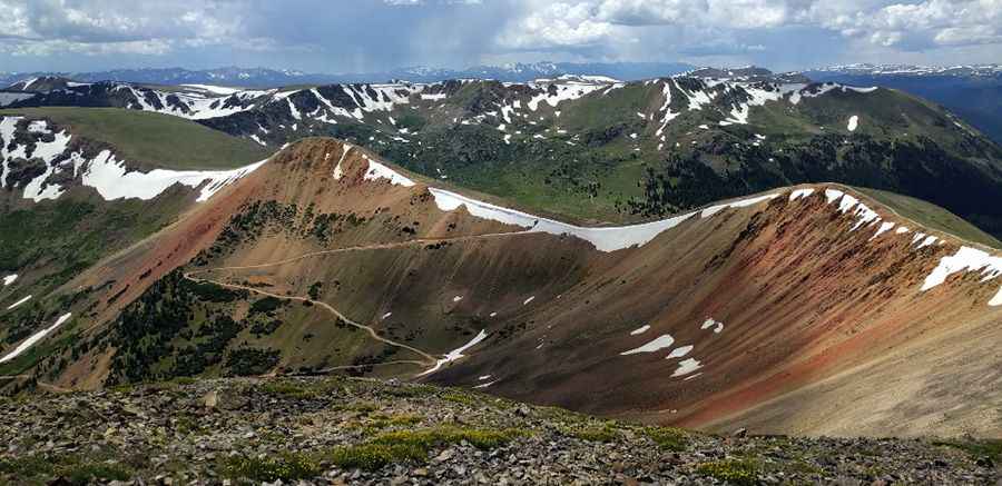
The trail takes approximately 45 minutes each way, so allow a couple of hours to make the roundtrip. When you get to the top of the pass, you’ll intersect with Red Cone and Handcart Gulch trails. A very steep decline on Red Cone makes it one of the most dangerous trails in the state. Unless you have the proper vehicle and experience, you’ll want to turn around and take Webster Pass Trail back down the mountain. Webster Pass Road provides a great opportunity to enjoy spectacular scenery along the Continental Divide. You will travel through large open alpine terrain as you climb up to the pass. There are also opportunities to connect with other 4WD roads in the area. It’s a thrilling drive with outstanding scenery. The picturesque drive follows the Snake River.
Pic: Brian Lee