Coffee Pot Road #600 is an improved gravel road in Colorado
Located in Garfield County, in the U.S. state of Colorado, Coffee Pot Road #600 offers both beautiful scenery and views. The trail begins climbing immediately, through switchbacks and near big drop-offs with no guardrails.
Where does Coffee Pot Road start and end?
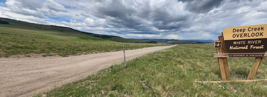
FDR 600 is an improved gravel road. The surface on this long and winding road is often loose, especially along the sides of the road. It links the Deep Creek confluence with the Colorado River, up the south edge of the Flattops to Deep Lake.
How long is Coffee Pot Road?
This gravel road is 41 km (26 miles) long. The first 10 miles of this road are exceptionally windy and narrow. Defensive driving is a must with drop-off edges, sharp blind curves, and parts of the road not wide enough to accommodate two vehicles. It starts very near I-70 on a well-marked road near Dotsero, that starts as pavement and quickly turns to a maintained dirt road. Near the top, it is slightly rougher. The drive is very scenic, through high desert, aspen groves, tundra, and alpine forests. Don’t become complacent; the road has no guardrails. The lower portion is suitable for passenger cars.
Is Coffee Pot Road open in winters?
Set high in the White River National Forest, the road tops out at 10,662 feet (3,250m) above sea level. It is closed in winters (open mid-April through mid-November). When using this road in the fall, be wary of the weather. This road is not plowed, and it is possible to become stranded up there if it snows heavily.
Pic: vie Photos