The unmaintained road to Vinegar Hill in Oregon
Vinegar Hill is a high mountain peak at an elevation of 2,471m (8,106ft) above sea level, located in Grant County, in the U.S. state of Oregon. It’s one of the highest roads in Oregon.
Where is Vinegar Hill?
The peak, formerly known as Greenhorn Peak, is located west of Baker City (the county seat of Baker County) in the eastern part of Oregon, within the Umatilla National Forest. The area is the location of many mining sites.
Is the road to Vinegar Hill unpaved?
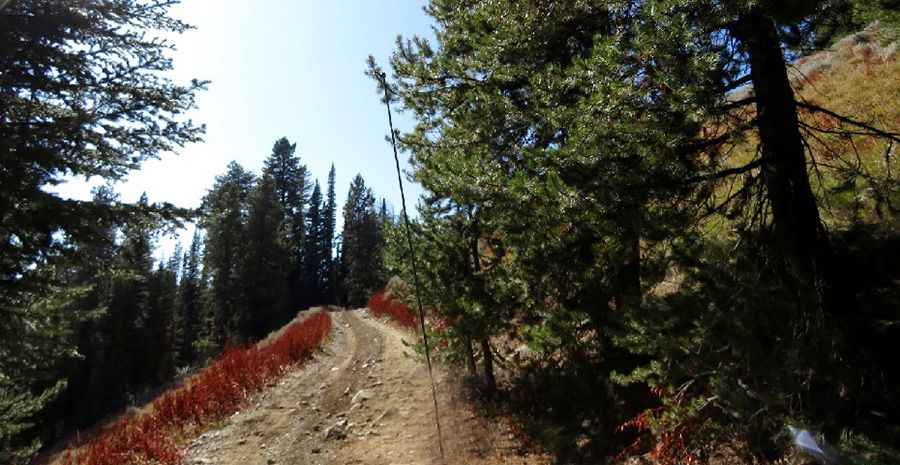
The road to the summit is totally unpaved with numerous ruts and rocks in the road. It’s called Forest Service Road 2010 (Vincent Creek Road). The road leads all the way to the summit, although it is likely the road will be blocked by fallen trees, snowdrifts, or may be washed out once you hit the unmaintained section. This road is generally maintained for roughly 7 miles. After that point, the road becomes much rougher. It is recommended that passenger vehicles park at this point. From the end of the maintained road the distance by 4WD road to the summit is about 6 miles.
How long is the road to Vinegar Hill?
The road to the summit is very steep, hitting a 22% maximum gradient through some of the ramps. Starting from the paved Up Middle Fork Road, near the ghost town of Austin, the ascent is 21.24km (13.2 miles) long. Over this distance the elevation gain is 1,248 meters. The average gradient is 5.87%.
Is the road to Vinegar Hill open in winter?
Set high in the Greenhorn Mountains, the road is usually passable from mid-June to October.
Pic: Barbara Morehead