How to drive the unpaved road to Blue Jay Hill in New Mexico?
Blue Jay Hill is a high mountain peak at an elevation of 3,182m (10,439ft) above sea level, located in Taos County, in the US state of New Mexico. It’s one of the highest roads in New Mexico.
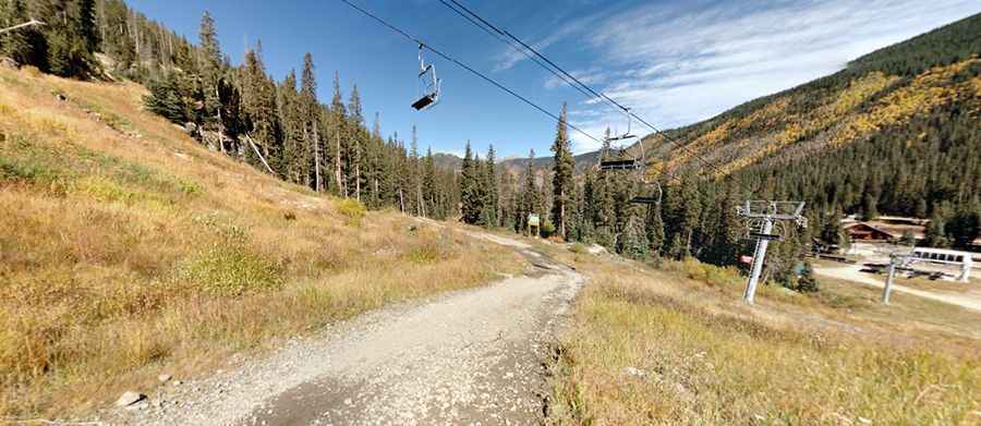
Where is Blue Jay Hill?
The peak is located in the northern part of New Mexico, within the Carson National Forest. It’s nestled within the Wheeler Peak Wilderness, a protected area famous for hosting New Mexico’s highest summits. During the summer months, it offers "wheelers" a dramatic vantage point overlooking the surrounding 13,000ft peaks.
🇺🇸 Blue Jay Hill Road Data
| Elevation | 3,182m (10,439ft) |
| Location | Taos Ski Valley (NM) |
| Avg. Gradient | 7.11% |
| Requirement | High-clearance 4x4 |
How long is the road to Blue Jay Hill?
Starting from Taos Ski Valley resort, the road to the summit is 3.05 km long. Over this distance, the elevation gain is 217 m and the average gradient is 7.11%.
Is the road to Blue Jay Hill unpaved?
The road to the summit is a classic mountain track: gravel, rocky, and often bumpy. Because it serves partly as a chairlift access trail for the ski resort, the road requires a high-clearance 4x4 vehicle. The drive is characterized by steep sections and sudden turns that can become extremely muddy and difficult to navigate after rain or summer thunderstorms.
Is the road to Blue Jay Hill open year-round?
In winter, the road is completely impassable to public vehicles due to heavy snowpack, as it becomes part of the active ski terrain. Always check the local weather forecast in Taos, as conditions at 10,000 feet can change from sunshine to freezing hail in minutes.
Pic: Dave Romero