Skyline Drive is one of the highest roads of Utah
Skyline Drive Scenic Backway is a high-altitude mountain road that follows the spine of the Wasatch Plateau in Sanpete County, in the U.S. state of Utah. Most of it is above 10,000 feet. It’s one of the highest roads in Utah.
How long is Skyline Drive Utah?
The road is 155 km (96.5 miles) long, running north-south from Tucker, on U.S. 6, to Salina Creek Road, to the east of Salina. The elevation of this scenic drive ranges from 9,000 to 10,897 feet (3,321m), which is the highest point. Keep your eye on the road, though, as you traverse 10,000-foot-high ridges barely wider than the road itself.
When was Skyline Drive Utah built?
It was built in the 1930s by the Civilian Conservation Corps and runs along the western ridgeline of the Wasatch Plateau. Sections of the road have been in place since the 1880s, and the mountains traversed by the road were used heavily by settlers.
Is Skyline Drive Utah paved?
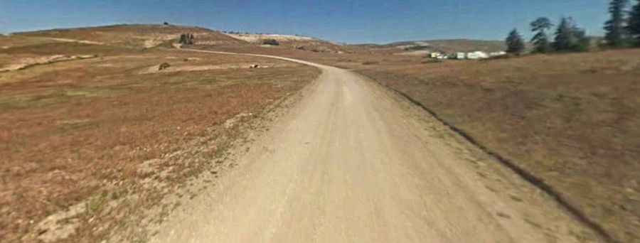
Set high in the central part of Utah, the drive ranks among the highest elevation roads in America and comprises FR150, 0173, UT31, and 150 roads. It’s mostly unpaved and provides access to forested mountains, alpine meadows, and numerous lakes, streams, and camping areas. Although many sections are suitable for passenger cars, high-clearance 4-wheel-drive vehicles are required for rougher parts. The northern section of this road can be driven in a passenger car year-round. The southern parts are only recommended for high clearance or four-wheel-drive vehicles.
Is Skyline Drive open in Utah?
Tucked away within Manti-La Sal National Forest, the road tops out by High Top, a high mountain pass at an elevation of 3,321m (10,897ft) above sea level. With its altitude, it is impassable even by four-wheel drive due to snow during all but a few summer and fall months of the year and can become impassable during summer storms. It is accessible July through September.
How long does it take to drive Skyline Drive in Utah?
The whole drive takes around 5-6 hours without stops. This road provides scenic views and offers a great opportunity for camping, fishing, and hunting. The drive is especially beautiful in the fall when leaves begin to change. You can see the Oquirrh Range, the Tavaputs, Mount Nebo, and the spectacular Roan Plateau from the peak. The road is also known as the Utah Adventure Highway. Cell service is unreliable. Be prepared for such conditions. Technical spurs from the main road include the climb to Buck Ridge and the route to Cox Knoll.