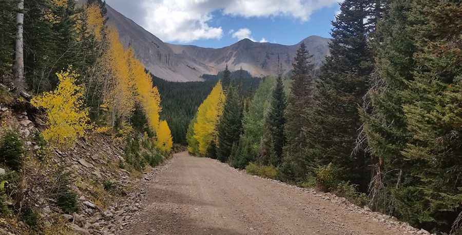
Driving the steep Forest Road 4717 to South Mountain in Utah
South Mountain is a high peak in the La Sal Mountains of San Juan County, Utah. While the summit towers above the range, the real challenge for drivers is the gravel track that climbs the southern flank of the mountain to an elevation of 3,258m (10,688ft) above sea level, making it one of the highest roads in Utah.
| Road facts: South Mountain (Forest Road 4717) | |
|---|---|
| Location | San Juan County, Utah (USA) |
| Max Road Elevation | 3,258 m (10,688 ft) |
| Length | 4.82 km (3.0 miles) |
| Average Gradient | 11.8% |
| Surface | Unpaved, narrow, and eroded gravel |
Is the road to South Mountain in Utah unpaved?
The road leading up the La Sal Mountains is entirely unpaved and is recognized as one of the highest roads in Utah. Known as Forest Road 4717, this track is notoriously narrow and heavily eroded. The surface is a mix of loose gravel and rocks that have been carved by years of harsh winters and snowmelt. It is a technical drive where a high-clearance 4x4 is not just recommended, but essential to avoid getting hung up on the deep ruts and rocky steps that define the route.
How steep is the climb on Forest Road 4717?
Starting from the junction with Forest Road 0128, the road tackles a fierce ascent over a 3.0-mile stretch. The climb gains 1,870 feet in elevation, resulting in a punishing average gradient of 11.8%. In the world of off-road driving, maintaining this incline on a loose surface requires steady momentum and, in many sections, the use of low-range gearing. The thin air at over 3,000 meters will also test the oxygen intake and cooling capacity of your vehicle's engine.
What are the main hazards on this high-altitude Utah road?
The primary hazards on Forest Road 4717 are the steep drop-offs and the unpredictable road conditions. The track is often "uncomfortable" due to the constant vibration from the washboard surface and embedded rocks. It is usually impassable during the winter months due to heavy snow. Even in summer, the weather in the La Sals can change in minutes; a sudden storm can make the steep 11.8% descent extremely dangerous as the gravel becomes slick. Proper engine braking is vital to prevent overheating your brake system on the way down.
What are the views like from the South Mountain road?
Reaching the high point of the road provides one of the best vantage points in southeastern Utah. From this elevation, the stark rock landscapes of the Colorado Plateau stretch out below, contrasted by the lush pinyon forest that surrounds the base of the La Sals like a green apron. Despite the breathtaking views, drivers must remain focused on the narrow path, as the shoulders are often soft and eroded, leaving no room for error when navigating the higher reaches of the mountain.
Pic: Cecil Tuley