Travel Guide to the Top of Mount Waas in Utah
Mount Waas is a high mountain peak located in Grand County, in the U.S. state of Utah. Set high in the Northern La Sal Mountains, the summit is accessed by either Beaver Basin or Miner’s Basin.
Via Beaver Basin
Located on the east side of the summit, the road is totally unpaved. It’s an old mining road. A 4WD high-clearance vehicle is required. The road is narrow and eroded enough to make travel a little uncomfortable. Accessibility is largely limited to the summer season. Beware of bears. The road ends near Beaver Basin at 3.282m (10,767ft) above sea level. It’s one of the highest roads in Utah.
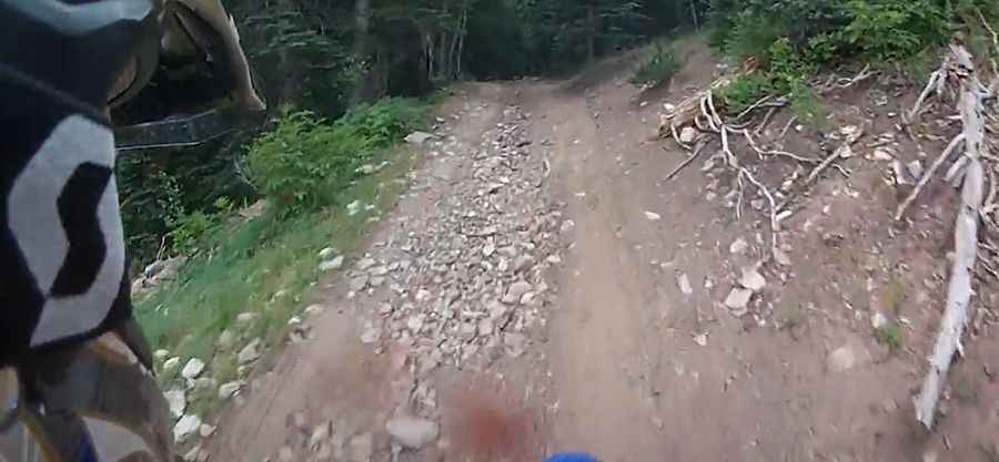
Via Miner’s Basin
Located on the west side of the summit, the road is totally unpaved with lots of bumps, rocks, and loose soil. It’s an old mining road called Forest Road 0065. Starting from La Sal Loop Road, the drive is 4.82km (3.0 miles) long. A 4WD high-clearance vehicle is required. Keep your fingers crossed you don't encounter anybody coming down in the narrow sections. Accessibility is largely limited to the summer season. Beware of bears. There is a pond, parking lot, and outhouse in Miner’s Basin. The road ends at 3.036m (9,960ft) above sea level.
Pic&video: High Valley