How to drive the unpaved road to Revenue Mountain in Colorado?
Revenue Mountain is a high mountain peak at an elevation of 3,725m (12,221ft) above sea level located in Clear Creek County, in the US state of Colorado. It’s one of the highest roads of Colorado..
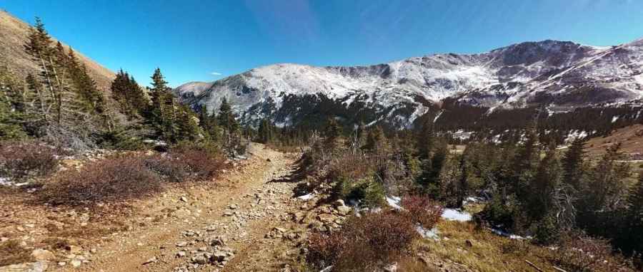
| Road facts: Revenue Mountain | |
|---|---|
| Location | Clear Creek County, Colorado, USA |
| Elevation | 3,725m (12,221ft) |
| Length | 11.5 km (from Guanella Pass Rd) |
| Average Gradient | 6.50% |
Where is Revenue Mountain?
The peak is located north of Santa Fe Peak, in the central part of Colorado, west of Denver, within the White River National Forest.
Is the road to Revenue Mountain unpaved?
The road to the summit is totally unpaved with embedded rocks, bumpy, muddy, and covered in loose scree. A high-clearance 4x4 vehicle is required. The final stretch comprises a brutal series of 5 sharp hairpin turns. These switchbacks are often filled with mud or snow late into the summer.
How long is the road to Revenue Mountain?
Starting from the paved Guanella Pass Scenic Byway, the road to the summit is 11.5-kilometer long. Over this distance, the average gradient is 6.50%. The road passes through historic mining districts where old machinery and debris can sometimes litter the side of the track.
Is the road to Revenue Mountain open year-round?
Set high in the Great Divide within the Mosquito Range, the road is not plowed in winters, and usually impassable from November through June. Always check the forecast for the Great Divide before starting, as a sunny afternoon in the valley can mean a blinding snowstorm at the summit within minutes.
Pic: Justin Wilhelm