A Memorable Road Trip to Mount Sheridan in Colorado
Mount Sheridan is a high mountain peak located in Park County, in the U.S. state of Colorado. South of the summit, an old mining road tops out at an elevation of 4,021 m (13,192 ft) above sea level. It’s one of the highest roads in Colorado.
Is the road to Mount Sheridan in Colorado unpaved?
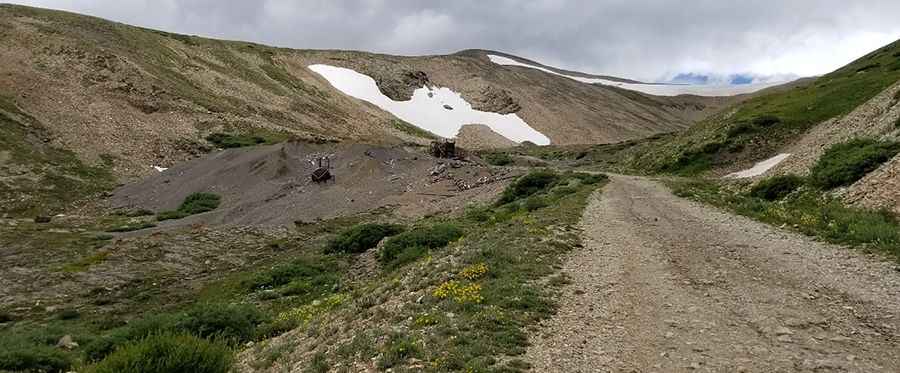
Set high in the heart of the Mosquito Range of the Colorado Rockies, in the central part of Colorado, the road to the summit is totally unpaved. It’s called County Road 18 (4 Mile Creek Road). 4x4 vehicle required. Due to the high elevations and exposure, the road is subject to strong winds and rapid weather changes.
How long is the road to Mount Sheridan in Colorado?
Starting from Fairplay, the road is 19.9 km (12.36 miles) long. Over this distance, the elevation gain is 1,052 m and the average gradient is 5.28%. It’s very steep in parts, hitting a brutal 23% maximum gradient through some of the ramps.
Is the road to Mount Sheridan in Colorado worth the drive?
The trail follows numerous remnants of Colorado's mining heritage. Plenty of mining structures remain in the area. Near the summit, you can admire the remnants of Dauntless Mine, an abandoned mine. From the summit, you can enjoy expansive views of South Park to the east and of the Sawatch Range to the west. This area is rich in gold, silver, and zinc mining history.
Pic: Wesley Cosme