How to get to the lookout at Mount Hough in California?
Mount Hough is a high mountain peak at an elevation of 2.204m (7,230ft) above sea level, located in Plumas County, in the U.S. state of California.
Where is Mount Hough?
The peak is located south of Greenville, in the northern part of California, within the Plumas National Forest.
When was Mount Hough Lookout built?
A fire lookout presence was first installed on the mountain in 1911, when a basic station and telephone connection were set up. By mid-year, an early lookout building was already in place. A few years later, in 1915, this was substituted with a short-tower design believed to follow the California Plan 4A style. In 1934, the site saw another upgrade with the construction of a BC-301 type cabin, improving observation capabilities. The current tower dates from 1986, when the previous structure was replaced once more. Today, it also supports microwave communication equipment in addition to fire surveillance duties. Mount Hough continues to be actively staffed for wildfire monitoring.
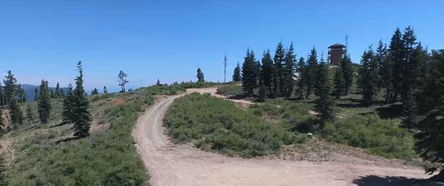
Is the road to Mount Hough unpaved?
The road to the summit is totally unpaved and a bit rough. It’s called Mount Hough Crystal Lake Road. While it might be accessible to most passenger vehicles in dry summer conditions, a high-clearance vehicle is highly recommended.
How long is the road to Mount Hough?
Starting from Quincy Junction, the road to the summit is 15.93 km (9.9 miles) long. Over this distance, the elevation gain is 1,200 m and the average gradient is 7.53%.
Is the road to Mount Hough open in winter?
Set high in the Sierra Nevada, the road to the peak is not maintained in the winter months and is impassable due to snow, typically from late fall through late spring.
How to get by car to Crystal Lake in Plumas County?
Near the summit there’s a beautiful mountain lake known as Crystal Lake. The view from the parking area just below the lookout is breathtaking.
Pic: David Conger