How to Get to the Summit of Pastora Peak in Arizona?
Pastora Peak is a high mountain peak at an elevation of 2,786m (9,140ft) above sea level, located in Apache County, in the U.S. state of Arizona. It's one of the highest roads in Arizona. The road is passable by most stock high-clearance 4wd vehicles.
Where is Pastora Peak?
The peak is located near the Four Corners on the Navajo Nation, in the northeastern part of Arizona.
How challenging is the road to Pastora Peak?
The road to the summit is totally unpaved. It’s called Indian Route 5036. The road conditions are challenging, with a mix of steep and rocky sections alongside flatter, nicer parts. The ascent is quite rough, and while it seems to have been graded previously, 4WD and high clearance are essential. It is strongly advised to avoid this road when wet due to a steep and narrow shelf section that becomes very slippery when muddy. Additionally, some sections of the road are significantly rutted from previous attempts by vehicles to navigate a muddy surface. If wet, the road is slick and messy.
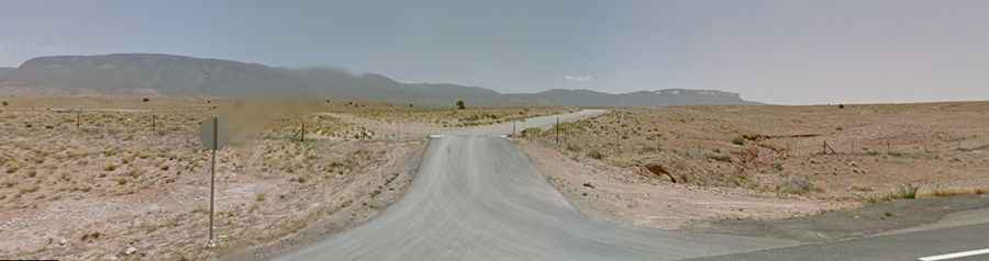
How long is the road to Pastora Peak?
Set high in the Carizzo Mountains, the road to the summit is 22.04km (13.7 miles) long, starting from the paved US-160. Over this distance, the elevation gain is 1143m (3,750 ft), and the average gradient is 5.18%. The road is marked with a small wooden sign and easily seen from the highway.