Mount Siegel: Driving the technical Pine Nut Mountains track
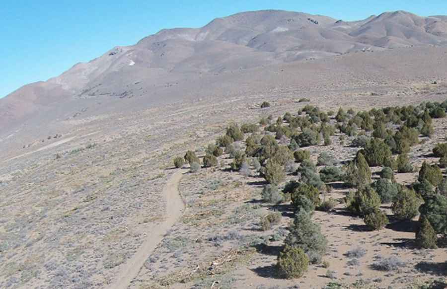
Mount Siegel is a prominent high-altitude peak reaching 2,833m (9,294ft) above sea level in Douglas County, Nevada. Situated within the rugged Pine Nut Mountains, the road to the summit is a demanding backcountry track that tests the technical limits of any vehicle. This is not a standard mountain drive; it is a raw, unpaved transit where the combination of steep gradients, loose volcanic rock, and extreme isolation requires a high-clearance 4x4 and advanced off-road driving skills.
| Road facts: Mount Siegel | |
|---|---|
| Location | Douglas County, Nevada (USA) |
| Max Elevation | 2,833m (9,294ft) |
| Length | 16.7 miles (26.8 km) |
| Surface | Rough gravel / Rocky / Muddy when wet |
How challenging is the 16.7-mile climb from US-395 to Mount Siegel?
The journey to the summit starts from the paved US-395 and covers 16.7 miles of increasingly technical terrain. The challenge of this route is the trail itself: the track is notoriously narrow, offering very few places for vehicles to pass each other. If you encounter oncoming traffic on the steeper sections, one driver must perform a high-consequence reverse maneuver along unprotected and "tippy" ledges. The surface is a mix of rough gravel and large ruts that can easily bottom out a vehicle without significant ground clearance. Maintaining momentum on the steep unpaved ramps is vital, especially as the road approaches the 2,833m mark where the traction on the loose desert soil becomes unpredictable.
Why is the Pine Nut Mountains weather a major hazard?
At nearly 2,900 meters, Mount Siegel is subject to the volatile high-desert climate of Nevada. The road is typically impassable during the winter months due to heavy snow, but the real danger comes during the wet season. Rain transforms the dry Pine Nut track into a thick, muddy sludge that fills the ruts and eliminates lateral grip. In these conditions, the average gradient feels much steeper as the tires struggle to clear the mud. Because this is a remote mountain area, the wind is usually quite strong, often blowing debris onto the track and increasing the risk of a puncture from sharp volcanic stones hidden under the silt.
What are the hazards of the "tippy" sections on the Mount Siegel road?
The geography of the Pine Nut Mountains means the road often follows ridgelines with significant side-slopes. These "tippy" sections are a major hazard for high-profile 4x4s, as the uneven ruts and bumpy surface can shift the vehicle's center of gravity toward the edge of the track. Navigating these parts requires a disciplined pace and a perfect understanding of your vehicle's suspension travel. The lack of safety barriers and the constant exposure to steep drops mean that any steering error on the technical hairpins can have immediate results. When descending, relying on your foot brake is a recipe for disaster; using low-range engine braking is the only way to manage the weight of the vehicle safely on the long unpaved descents.
What mechanical preparation is needed for the Nevada backcountry?
Driving toward Mount Siegel is a journey into an isolated sector of Nevada where self-sufficiency is the only operational protocol. Before leaving the US-395, a full mechanical audit of your 4x4 is mandatory, focusing on cooling system integrity and tire sidewall strength. The sharp rocks and deep ruts can easily damage standard components, so carrying a full-sized spare tire and recovery gear is essential. Because of the isolation of Douglas County's higher peaks, help is miles away and cell coverage is non-existent in the deeper canyons. Ensure your vehicle is equipped with undercarriage protection to avoid damage from the large rocks that characterize this high-mountain transit.
Pic: http://elevation.maplogs.com/poi/mount_siegel_mt_siegel_nevada_usa.926.html