Driving the Snake Creek Road to Johnson's Mill in Nevada
Johnson's Mill is a high-altitude historic mining site reaching an elevation of 3,074m (10,085ft) above sea level, located in White Pine County, Nevada. Situated within the Great Basin National Park, the route to the ruins follows the Snake Creek Road, one of the highest and most isolated unpaved transits in the state, right on the border with Utah. It's one of the highest roads in Nevada.
| Road facts: Snake Creek Road to Johnson's Mill | |
|---|---|
| Location | White Pine County, Nevada (USA) |
| Elevation | 3,074 m (10,085 ft) |
| Length | 18 miles (29 km) |
| Surface | Unpaved / Rough Gravel / Dirt |
How to drive the 18-mile Snake Creek Road?
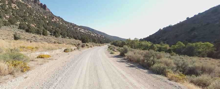
Starting from Garrison, Utah, the 18-mile (29 km) drive to the mill is a sustained climb into the heart of the Snake Range. The first section of the Snake Creek Road is a graded gravel track, but as you enter the National Park boundaries and gain altitude, the surface quality degrades. Logistically, the final sector of the climb is more a narrow path than a road, characterized by embedded rocks and steep gradients. A high-clearance vehicle is a technical requirement to navigate the ruts and avoid undercarriage damage on the last few miles toward the ruins.
What are the hazards of driving to Johnson's Mill?
Technically, the main hazard on Snake Creek Road is its extreme isolation and the high-altitude environment. At 3,074m, engines will experience significant power loss, and the road is entirely unpaved. During the winter months and late spring, the route is impassable due to heavy snowpack and mud. Logistically, there are no services or cellular signals in this sector of White Pine County. Drivers must be self-sufficient, carrying a full-sized spare tire and enough fuel for the 36-mile round trip, as the high-torque climbing required for the final miles will drastically increase fuel consumption.
Best time to visit the Great Basin high roads
The window for reaching Johnson's Mill is limited to the summer and early fall (July to October). Even in summer, sudden thunderstorms can wash out sections of the lower Snake Creek Road, turning the dirt into a slick surface that requires 4x4 engagement for traction. When descending from 10,000ft, use low-range engine braking to manage your speed on the narrow paths; the lack of guardrails and the steep drops into the canyon floor leave no room for braking errors. Always check with the Great Basin National Park rangers for current roadbed conditions before attempting the final ascent to the historic mill site.
Pic: Paul Plath