A Memorable Road Trip to Mount Grant in Nevada
Mount Grant is a high mountain peak at an elevation of 3,388m (11,115ft) above sea level, located in Mineral County, in the U.S. state of Nevada. The road to the summit has steep cliffs along the shoulder, so drive cautiously. It's one of the highest roads in Nevada.
Where is Mount Grant?
The peak is located south of Walker Lake, in the western part of Nevada, near the California border.
Why is it called Mount Grant?
The peak was named after Ulysses S. Grant, the 18th President of the United States.
Can I drive to Mount Grant?
The peak is located within the Hawthorne Army Depot, resulting in very limited public access, as most of the area is owned by the military. Permission is required to access the road.
Is the road to Mount Grant unpaved?
Set high in the Wassuk Range, the road to the summit is completely unpaved. A 4WD vehicle with high clearance is required. The road is usually closed from late October through late June or early July. It is also very steep, with some sections reaching a 10% maximum gradient.
How long is the road to Mount Grant?
Starting at Walker Lake, the ascent is 24.78km (15.4 miles) long. Over this distance, the elevation gain is 2,057 meters, with an average gradient of 8.30%.
How to Drive to Mount Grant Peak?
The journey begins at an elevation of 4,000 feet, gradually ascending to 9,000 feet over the first 9 miles. Early on, a narrow canyon section requires careful navigation, but beyond that, the road widens enough for two vehicles to pass comfortably, allowing speeds of up to 30 mph on well-graded terrain.
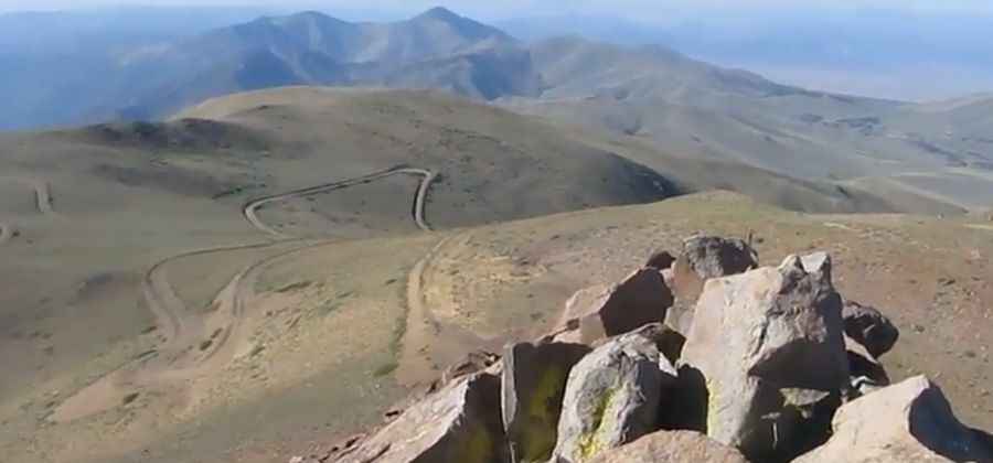
In the initial stretch, the road winds through a picturesque canyon, lined with willows, aspens, and remnants of historic structures. As you approach mile 9, the landscape transitions into vast, high-altitude terrain, where an old rusted sign marking Mount Grant directs travelers to the left.
From this vantage point, you’ll spot steep switchbacks zigzagging up the mountain. Despite some scattered small rocks, the road remains well-maintained, and high clearance is not necessary. However, those uncomfortable with heights might find this section intimidating.
The final 6 miles ascend a series of sharp switchbacks, bordered by steep drop-offs. The road narrows considerably, with limited pullouts for passing vehicles. However, traffic is minimal, as the gate locks behind you. At the summit, a spacious turnaround awaits, offering breathtaking views from an elevation of over 11,000 feet.
Pic: Mark Adrian