A defiant road to Glacier Mountain in Colorado
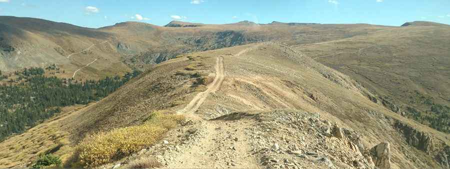
Glacier Mountain is a high mountain peak at an elevation of 3,793 m (12,444 ft) above sea level, located in eastern Summit County, in the U.S. state of Colorado. Full-size vehicles should not attempt to drive all the way, as there are a few very narrow spots. It’s one of the highest roads in Colorado.
Where is Glacier Mountain in Colorado?
The peak is located west of Denver, in the north-central part of Colorado, between Keystone Mountain and Santa Fe Peak.
Is the road to Glacier Mountain in Colorado unpaved?
The road to the summit is totally unpaved. It’s called Forest Service Road #275 (Saints Johns Road). The road is not easy. A 4-wheel-drive (4WD) vehicle with high clearance is required. A car with all-wheel-drive (AWD) will not make it. This trail provides a fairly easy route to the top of the mountain. If you go by truck or 4x4, there is no problem, and you can reach the final parking lot.
Is the road to Glacier Mountain in Colorado open in winter?
Set high within the White River National Forest, the road is totally impassable in winter, usually until mid-June. It is recommended to go in good weather.
How long is the road to Glacier Mountain in Colorado?
The road to the summit is pretty steep. Starting at the town of Montezuma, the road to the summit is 6.5 km (4.03 miles) long. Over this distance, the elevation gain is 649 meters. The average gradient is 9.98%, hitting a 21.7% maximum gradient through some of the ramps.
Is Glacier Mountain in Colorado worth the drive?
Located in the north-central part of Colorado, the top of the mountain is huge and flat, with plenty of parking. The views are amazing. It offers incredible views of Summit County and Clear Creek County peaks. The summit is crowned with old mining roads and claims, part of Colorado's historic mining legacy.
Pic: Chris Knaffle