A memorable road trip to Mount Sherman in Colorado
Mount Sherman is a high mountain peak located on the boundary between Park and Lake counties, in the U.S. state of Colorado.
Why is it called Mount Sherman?
The peak is named after the Union General William Tecumseh Sherman who, during the Civil War, practiced a scorched earth policy while marching to Atlanta in 1864.
Where is Mount Sherman?
The peak is located west of Alma, in the central part of Colorado, high in the middle of the Mosquito Range of the Rocky Mountains of North America.
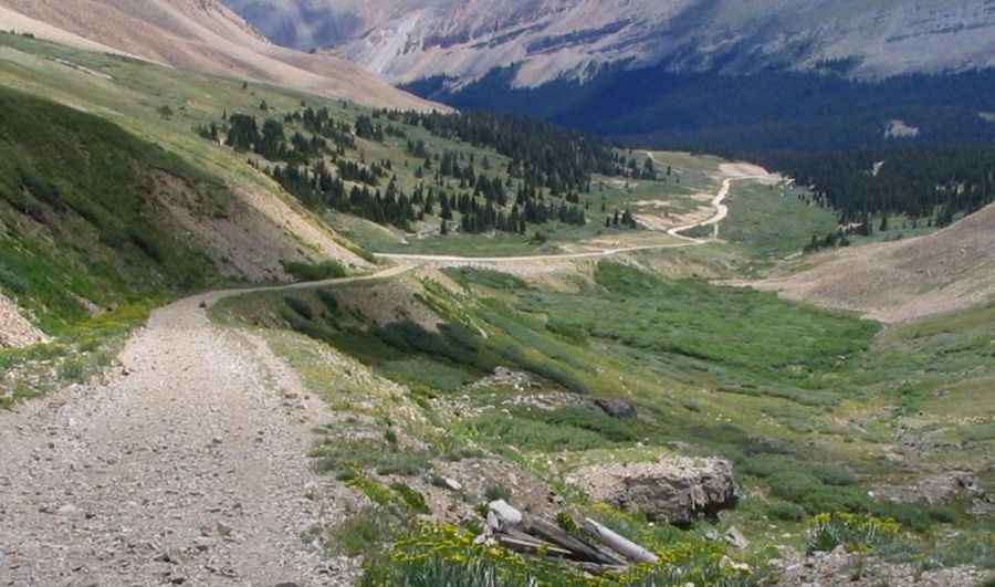
How to get to Mount Sherman in Colorado?
Two old mining roads approach to the summit: County Road 2B and County Road 18. Both roads are impassable in winters, often until July 4th or later.
County Road 2B:
The road ends at 3.878m (12,723ft) above sea level. It’s one of the highest roads in Colorado. It is totally unpaved and very steep hitting an 18% of maximum gradient through some of the ramps. Starting at Leadville, the county seat of Lake County, the ascent is 12.87km (8.0 miles) long. Over this distance the elevation gain is 793 meters. The average gradient is 6.16%. The trail is narrow with few places for passing so meeting someone can be a challenge. Keep an eye on the weather for thunderstorms and lightning. Near the summit are remnants of abandoned old mining facilities. These are full of rusty nails and thinly-covered mine shafts, so be safe and don’t get too close. The road can be driven in many stock SUVs equipped with 4x4 & higher clearance. However, the road is continuously rocky and does present some degree of clearance challenges for stock SUVs.
County Road 18 (4 Mile Creek Road):
The road ends at 3.950m (12,959ft) above sea level. It’s one of the highest roads in Colorado. It is totally unpaved and very steep hitting a 16% of maximum gradient through some of the ramps. Starting at Fairplay, the county seat of Park County, the ascent is 22km (13.67 miles) long. Over this distance the elevation gain is 942 meters. The average gradient is 4.28%. The maintained (jeep) trail is narrow with few places for passing so meeting someone can be a challenge. Keep an eye on the weather for thunderstorms and lightning. Near the summit are remnants of abandoned old mining facilities. The road can be driven in many stock SUVs equipped with 4x4 & higher clearance. However, the road is continuously rocky and does present some degree of clearance challenges for stock SUVs. The road ends at Hilltop Mine, an abandoned lead, zinc, and silver mine. The mine was active until about 1910. It is still very well preserved. This is a great trail that offers a little bit of everything -- rocky challenges, fantastic scenery, Colorado history, and access to some great hiking and fishing. Before a mile of the end of Fourmile Creek Road, the road turns off to Peerless Mountain.
Pic&more info: http://stevegarufi.com/mountsherman.htm