The road to Trico Peak in Colorado is not for the faint of heart
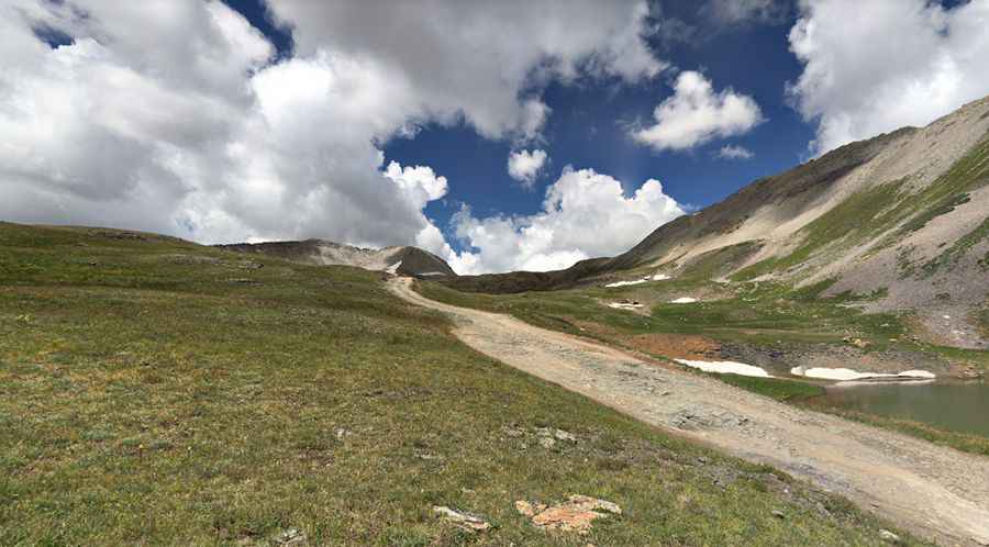
Trico Peak is a high mountain pass at an elevation of 3.849m (12,627ft) above sea level, located in San Miguel County in the U.S. state of Colorado. It's one of the highest roads in Colorado.
Where is Trico Peak?
The pass is located north of Black Bear Pass, in the southwestern portion of Colorado.
Is the road to Trico Peak unpaved?
The road to the summit is totally unpaved. It’s called Black Bear Road (Forest Service Road 648). The road is narrow and intense. Open to all motorized vehicles; however, it is recommended for high-clearance, short wheelbase, 4-wheel-drive vehicles. There are very few spots wide enough to pass from here on down. It is known as one of the most dangerous roads in the country due to narrow shelf segments and unnerving drop-offs.
Is the road to Trico Peak open in winter?
Set high in Colorado’s Rocky Mountains, this road, which passes Bridal Veil Falls, the highest waterfall in Colorado, is open only a few months, from late summer (usually the last week of July) to early fall, but it can be closed anytime when the access is not cleared of snow.
How long is the road to Trico Peak?
The road is 17.86km (11.1 miles) long, running east–west from U.S. 550 – Million Dollar Highway – to Telluride, a former Victorian mining town.
Pic: John Carter