What are the driving conditions on the road to Apache Point Observatory?
The Apache Point Observatory is a high-altitude research facility at an elevation of 2,801m (9,189ft) above sea level, located in Otero County, in the US state of New Mexico. The access is via Apache Point Road, a short mountain spur that connects the observatory with the Sunspot Highway (NM Hwy-6563).
| Road facts: Apache Point Road | |
|---|---|
| Location | Otero County, New Mexico (USA) |
| Elevation | 2,801 m (9,189 ft) |
| Length | 1.0 mile (1.6 km) |
| Average Gradient | 2.6% |
How difficult is the ascent on Apache Point Road?
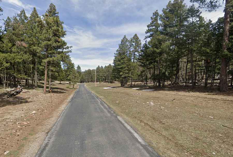
Starting from the Sunspot Highway junction, the road to the summit is 1.0 mile long. Over this distance, the elevation gain is 138 ft, resulting in an average gradient of 2.6%. While the incline is moderate, the challenge lies in the road's narrow profile and the lack of a formal shoulder. The asphalt is fully paved but often has edge degradation and accumulation of organic debris, which can reduce tire friction, particularly during the frequent afternoon thunderstorms common in the south-central New Mexico ranges.
What are the seasonal hazards at 2,801m in Otero County?
At nearly 3,000 meters, Apache Point Road is subject to rapid icing cycles. The high density of coniferous trees creates permanent shaded zones where black ice can persist long after the main highways have cleared. Safety protocols mandate checking for frozen runoff crossing the roadbed, as the drainage capacity of the narrow asphalt can be overwhelmed by melting snow. Despite its short length, the situational awareness required is high; the road is a working transit for observatory staff and equipment, and encountering heavy transport vehicles on the narrow curves requires precise lane positioning.