How to get to the lookout at the summit of Roof Butte in Arizona?
Roof Butte is a high mountain peak at an elevation of 2,996m (9,829ft) above sea level, located in Apache County, in the U.S. state of Arizona. It's one of the highest roads in Arizona.
Where is Roof Butte?
The peak is located in the heartland of the Navajo Nation, in the northeastern part of Arizona, near the New Mexico border.
Is Roof Butte worth the drive?
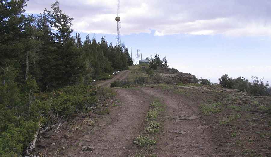
At the summit, there’s a manned lookout tower built in 1960. Its remoteness keeps visitation to a minimum. The surrounding area is high-elevation grass meadows and spotty forest, and is quite lovely.
Is the road to Roof Butte unpaved?
The road to the summit is called Indian Route 30. The road is a moderately rough dirt road that goes to the top. It’s mostly unpaved but smooth, and in dry conditions should be passable to most vehicles. High clearance would be the only minimum requirement, though other sources state that it's a bit of a bumpy ride, and you’ll need a 4x4 for sure, and packing a spare.
How long is the road to Roof Butte?
The road to the summit is very steep, hitting an 11% maximum gradient through some of the ramps. Starting at Indian Route 13, near Buffalo Pass, the ascent is 6.59km (4.1 miles) long. Over this distance, the elevation gain is 408m (1,339ft). The average gradient is 6.19%.
Is the road to Roof Butte open in winter?
At this elevation, it is the highest peak of the Chuska Mountains, which run in a north-northwest direction across the Arizona–New Mexico border. The road is usually impassable in winter.
Pic&more info: http://www.surgent.net/highpoints/az/range/roofbutte.html