How to get by car to Bearwallow Mountain in New Mexico?
Bearwallow Mountain is a high mountain peak at an elevation of 3,039 m (9,970 ft) above sea level, located in Catron County, in the U.S. state of New Mexico. It’s one of the highest roads in New Mexico.
Where is Bearwallow Mountain?
The peak is located in the southwestern part of New Mexico, within the Gila National Forest.
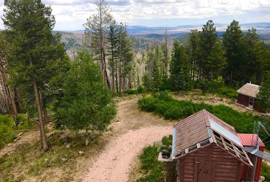
What’s at the summit of Bearwallow Mountain?
At the summit, there’s a lookout tower built in 1940. It provides stunning views of the Blue Wilderness, the Gila Wilderness, the Aldo Leopold Wilderness, and the White Mountains in Arizona. If you're afraid of bears, you might want to avoid this place.
Is the road to Bearwallow Mountain unpaved?
The road to the summit is totally unpaved and rough in parts. It’s called Bearwallow Fire Road. The road is usually passable with high-clearance vehicles, though don't bring a motorhome or tow a trailer up here because you won't be able to turn around and will have to back down a long way. If it’s muddy or snowy, a 4x4 vehicle is required.
How long is the road to Bearwallow Mountain?
The road is pretty steep. Starting at Bursum Road, the ascent is 12.39 km (7.7 miles) long, with an elevation gain of 351 meters. The average gradient is 2.83%, hitting a 13.5% maximum gradient through some of the ramps.
Is the road to Bearwallow Mountain open in winter?
Set high in the Mogollon Mountains, the road is usually open from June through October. It is impassable during winter months due to the risk of icy, snowy conditions.
Pic: Jeremy Pettitt