How to drive the unpaved road to lookout at Eagle Peak in New Mexico
Eagle Peak is a high mountain peak at an elevation of 2.987m (9,801ft) above sea level, located in Catron County, in the US state of New Mexico.
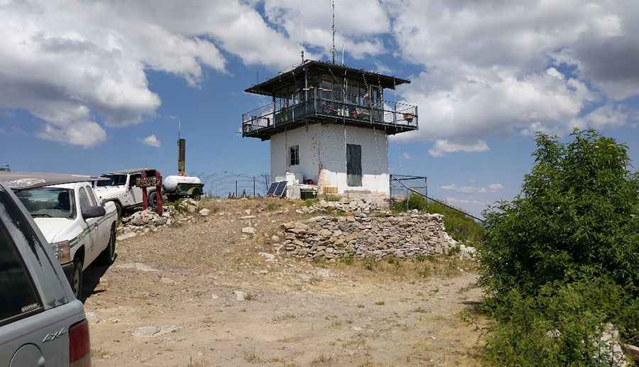
Where is Eagle Peak?
The peak is located near the town of Reserve, in the western part of New Mexico, within the Gila National Forest. The summit is the highest point in the Tularosa Mountains.
Why is there a road to Eagle Peak?
At the summit there’s a fire lookout tower. Built in 1955, the structure features a 14'x14' steel cab sitting on a 10-foot concrete blockhouse base. It is staffed every fire season.
Is the road to Eagle Peak unpaved?
The road to the summit is totally unpaved and quite treacherous. It’s called Eagle Peak Road #38. It features 2 sharp hairpin turns near the end of the road. As long as you have a Jeep or any 4x4 vehicle with a higher than average clearance, you're good.
How long is the road to Eagle Peak?
Starting from State Route 233, the road to the summit is 5.14km (3.2 miles) long. Over this distance, the elevation gain is 469m (1,539 ft) and the average gradient is 9.12%.
Is the road to Eagle Peak open year-round?
Set high in the Tularosa Mountains, the road is not plowed in winters.
Pic: Taylor Martins