A Brutally Steep Road to Lenawee Lift in Colorado
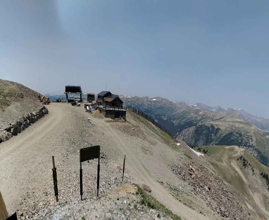
Lenawee Mountain is a high mountain peak located in Summit County, in the U.S. state of Colorado. West of the summit, a chairlift service road tops out at 3,818 m (12,526 ft) above sea level. It’s one of the highest roads in Colorado.
Where is Lenawee Mountain?
The peak is located west of Denver, in the central part of Colorado, within the White River National Forest.
Why is Lenawee Lift famous?
Lenawee Lift is part of the Arapahoe Basin Ski Area, and it is said to be one of the highest chairlifts in North America.
Is the road to Lenawee Lift unpaved?
The road to maintain the chairlift is totally unpaved. It is mostly used to provide access to maintain ski lifts and lodges. A 4x4 vehicle is required due to its condition and steepness, hitting a 19% maximum gradient through some of the ramps. The last part of the climb is very intimidating. It is well above timberline, and the trail is not wide at all.
When is the road to Lenawee Lift open?
Set high in the Rocky Mountains of the United States, the trail is open in the months when snow skiing is not available.
How long is the road to Lenawee Lift?
Starting at the paved Loveland Pass Road, the ascent is 3.70 km (2.3 miles) long. Over this distance, the elevation gain is 462 meters. The average gradient is 12.48%.
Pic: Wenwei Yan