Road Trip Guide: Conquering Alamo Peak in New Mexico
Alamo Peak is a high mountain peak at an elevation of 2,825m (9,270ft) above sea level, located in Otero County, in the U.S. state of New Mexico.
Where is Alamo Peak?
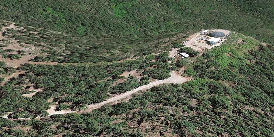
The peak is located east of Alamogordo, in the southern part of New Mexico, within the Lincoln National Forest. The summit hosted a lookout built in 1926 by the CCC. The site is now occupied by a U.S. Air Force telemetry antenna for Holloman Air Force Base.
How long is the Road to Alamo Peak?
The road to the summit is fully paved but pretty narrow. It's called Alamo Peak Road (Forest Service Road 64D). It is 3.05 km (1.9 miles) long, starting at Sunspot Highway (Scenic Byway 6563). The road is steep in parts, hitting a 12% maximum gradient through some of the ramps.
Is the Road to Alamo Peak Open?
Set high in the Cornudas Mountain range, this road is usually impassable from late October through late June or early July (depending on snow). According to some sources, the summit has no public access now, with posted "No Trespassing" signage.