Coyote Flat is a steep rocky road for high clearance 4X4's in California
Coyote Flat is a high mountain plateau at an elevation of 3.061m (10,042ft) above sea level, located in Inyo County, in the U.S. state of California. It’s one of the highest roads of California.
Where is Coyote Flat?
Coyote Flat is located in the eastern central part of California, within the Inyo National Forest.
When was the road to Coyote Flat in California built?
It was built in the 1940s as a mining road.
How long is the road to Coyote Flat in California?
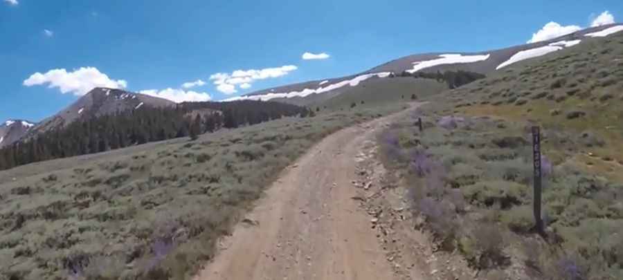
The road to the summit is totally unpaved. It’s called Coyote Valley Road. Starting at Bishop, the road is 25.74km (16.0 miles) long.
Is the road to Coyote Flat in California open?
Set high in the Californian Eastern Sierra, the road is not plowed in winters. It’s usually impassable from late October through late June or early July. There are no water or facilities in this area.
Is Coyote Flat in California worth it?
The drive is pretty scenic, offering grazing deer and views of Palisade Glacier at the south end of the Flat. You can spot coyotes, bears, and mountain lions.
Is the Coyote Flat Road challenging?
The road is pretty steep and rocky with some sandy parts. Much of the trail is easy, but rocky sections are moderate. It’s best suited for high clearance 4X4 vehicles. The road climbs steeply after leaving Bishop, following canyons and along ridges in pine forests. In mid-summer, bring your mosquito repellent.
Pic: David Nagy