Road trip guide: Conquering Leavitt Lake in California
Leavitt Lake is an alpine lake at an elevation of 2.917m (9,570ft) above sea level, located in Mono County, in the U.S. state of California. It’s one of the highest roads in California.
Where is Leavitt Lake?
The lake is located on the eastern part of California, near the border with Nevada.
Can you drive to Leavitt Lake?
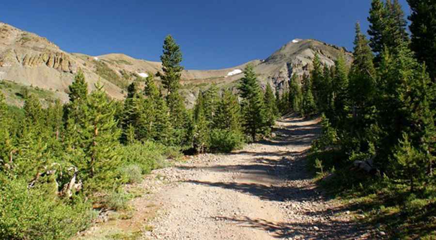
Tucked away in Humboldt-Toiyabe National Forest, the road to the lake is called Leavitt Lake Road (Forest Service Road 077).
How is the road to Leavitt Lake in CA?
It’s a pretty rough dirt road, only accessible with an SUV with high clearance and 4-wheel drive. The drive includes a couple of seasonal shallow stream crossings: do not attempt this with a passenger vehicle.
How long is the road to Leavitt Lake in CA?
Starting at the paved CA-108 road, the drive is 4.50km (2.8 miles) long. The road is very steep, hitting a 15% maximum gradient through some of the ramps. Over this distance, the elevation gain is 338 meters. The average gradient is 7.51%.
Is the road to Leavitt Lake in California open?
Set high on the eastern crest of the Sierra Nevada Mountain Range, in the east-central portion of California, the road is not plowed in winters. It is usually closed to vehicles well into the summer due to snow. The lake can be iced over until early July. South of the lake, a minor gravel road climbs up to 3.246m (10,649ft) above sea level.
Pic&more info: https://autoramblings.com/sportsmobile/?p=1928