How to drive the unpaved road to the lookout at Bald Mountain in California?
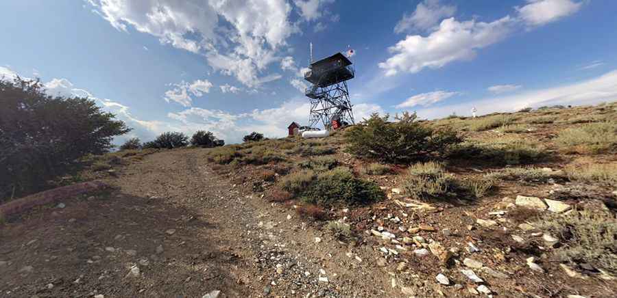
Bald Mountain is a high mountain peak at an elevation of 2.847m (9,339ft) above sea level, located in Tulare County, in the U.S. state of California. It's one of the highest roads of California.
Where is Bald Mountain?
The peak is located north of Lake Isabella, in the central part of California, within the Sequoia National Forest.
Why is there a road to Bald Mountain?
At the summit there’s a fire lookout built in 1954. The summit provides superb views towards the north including: Olancha Peak, Mt. Whitney, and Mt. Langley. Looking east you can see all the way to Telescope Peak in Death Valley.
Is the road to Bald Mountain unpaved?
The dirt road to the summit is totally unpaved. It’s called Bald Mountain Trail (Forest Route 22S77). High clearance vehicles required.
How long is the road to Bald Mountain?
Starting from Sherman Pass Road, the road to the summit is 3.37km (2.1 miles) long. Over this distance, the elevation gain is 239m (787 ft) and the average gradient is 7.09%.
Is the road to Bald Mountain open year-round?
Set high in Southern Sierra, the road is usually open from late May/early June to late October/early November, depending on weather.
Pic: James Hatton