How to get by car to Monjeau Peak in New Mexico?
Monjeau Peak is a high mountain peak at an elevation of 2,927m (9,603ft) above sea level, located in Lincoln County, in the U.S. state of New Mexico.
Where is Monjeau Peak?
Set high in the Sierra Blanca mountain range, within the Lincoln National Forest, the peak is located on the southern part of New Mexico, to the north of Ruidoso.
Can you drive to Monjeau Peak in New Mexico?
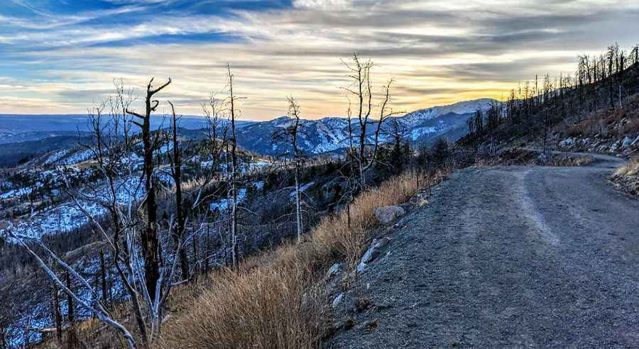
The dirt road to the summit is pretty curvy and somewhat rough and rocky. It’s called Forest Service Road 117. A car can make the trip in good weather, but a high clearance vehicle is recommended. The last mile or so has been closed by a gate for some time, so no vehicle traffic goes to the top.
Is the road to Monjeau Peak in New Mexico open in winters?
For your safety, be sure to check the weather forecast before you begin your trip. Visit during the summer months, as the road leading to the summit closes during the winter with the advent of snow. Use caution if it looks like it is going to rain or if there is snow on the road, as part of the road is steep and winding.
How long is the road to Monjeau Peak?
The road to the summit is very steep. Starting from the paved County Road 532, the ascent is 9.17km (5.7 miles) long. Over this distance, the elevation gain is 666 meters. The average gradient is 7.26%.
How to get to Monjeau Lookout in New Mexico by car?
The summit hosts a lookout tower known as Monjeau Lookout. It was built originally in 1936 and then reconstructed in 1940 as part of a Civilian Conservation Corps project. Still in active use, the lookout is a popular destination for forest visitors. The drive offers panoramic views.
Pic: Stephen Tures