How difficult is the unpaved Forest Road 445 to Don Fernando Peak?
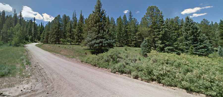
Don Fernando Peak, also known as Sierra de Don Fernando, is a high mountain summit reaching an elevation of 3,147m (10,324ft) above sea level in Taos County, New Mexico. Located in the northern part of the state, south of Taos, the drive to the top is one of the highest mountain roads in New Mexico. This is a primitive journey through the dense timber of the Carson National Forest, where the smooth forest floor can quickly turn into a rocky, bone-jarring climb that demands a capable vehicle and a driver who knows how to manage traction on loose soil.
| Road facts: Don Fernando Peak | |
|---|---|
| Location | Taos County, New Mexico (USA) |
| Elevation | 3,147 m (10,324 ft) |
| Length | 7.7 miles (12.4 km) from Valle Escondido |
| Average Gradient | 4.85% |
| Surface | Gravel / Rocky / Dirt |
Is the road to Don Fernando Peak unpaved?
The road to the summit, strictly known as Forest Road 445, is entirely unpaved. While the lower sections might look like a simple dirt path through the pines, the higher you get toward the 3,147m peak, the more the surface deteriorates. You will face a mix of loose gravel, embedded rocks, and deep ruts carved by mountain runoff. A high-clearance 4x4 is mandatory; standard cars will likely bottom out or lose traction on the steeper, silt-covered ramps. This is a "shelf road" in several spots, meaning there are no guardrails between your tires and the steep slopes of the Sangre de Cristo Mountains.
How long is the Forest Road 445 ascent from Valle Escondido?
The climb starts near Valle Escondido and covers 7.7 miles (12.4 km) of continuous ascent. Over this distance, you gain 1,975 feet in vertical elevation, resulting in an average gradient of 4.85%. However, this figure is deceptive. The track features several sharp pitches where the grade hits double digits, forcing your engine to work hard in the thin air of the Carson National Forest. At over 10,000 feet, your vehicle will lose a significant amount of power, so keeping a steady momentum is key to avoiding getting stuck in the softer patches of dirt that appear after the summer rains.
When is the best time to drive to Don Fernando Peak?
Due to its extreme altitude, Forest Road 445 is strictly a seasonal route. The road is subject to seasonal closure during the winter months when deep snow makes the track completely impassable. The best window for a successful drive is from June through August. Even in mid-summer, you must be wary of the "monsoon" season in New Mexico; sudden afternoon thunderstorms can turn the dry dirt into a slick, muddy trap in minutes. If the clouds start building over Taos, it is time to turn around, as the descent back to Valle Escondido becomes dangerously slippery when the red clay gets wet.
What are the main hazards on the Don Fernando Peak road?
The biggest risk on this route is a combination of isolation and the unpredictable state of the ground. There are no services, no cell signal, and very few other travelers on this high-altitude track. You need to carry a full-sized spare tire, as the sharp rocks along the Forest Road 445 are notorious for shredding sidewalls. Make sure your cooling system is in top shape before you start the 7.7-mile haul; the long climb in low gears can easily make a radiator boil over. Safety here means being prepared to spend the night if the weather turns or a mechanical failure leaves you stranded at 10,324 feet.