How to get by car to Ski Santa Fe in New Mexico?
Ski Santa Fe is a ski resort at an elevation of 3.167m (10,390ft) above sea level, located in Santa Fe County, in the U.S. state of New Mexico. It’s one of the highest roads of New Mexico.
Where is Ski Santa Fe?
The resort is located in the northern part of New Mexico, within the Santa Fe National Forest.
Is the road to Ski Santa Fe paved?
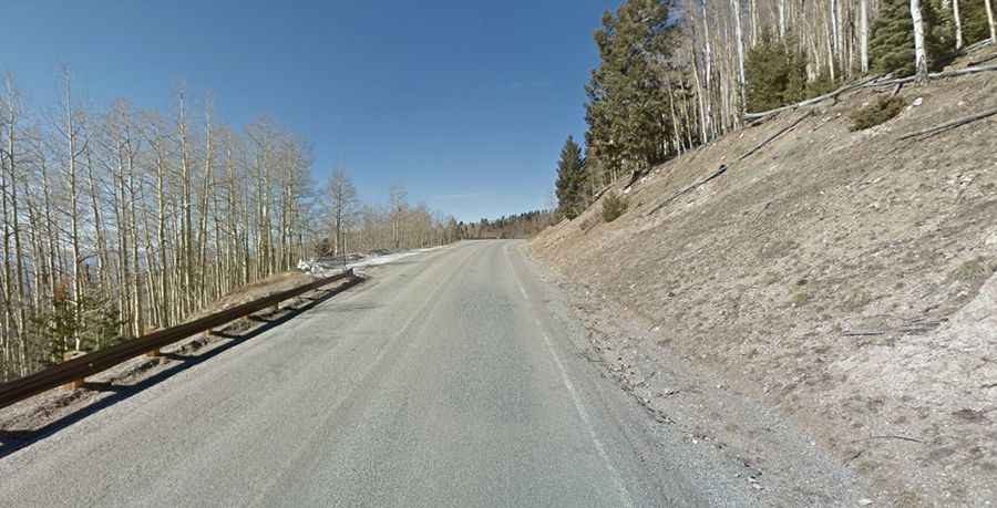
The road to the resort, also known as Santa Fe Ski Basin, is totally paved. It’s called New Mexico State Highway 475 (Santa Fe National Forest Scenic Byway). The ski station is among the highest ski areas in the continental United States.
How is the drive to Ski Santa Fe?
Nestled high in the beautiful Sangre de Cristo Mountains, the drive is very scenic. There are many great stops on the way. In addition to great views there are also a number of campgrounds and picnic areas along the way. This drive is most scenic in the autumn when the aspen colors are in full effect.
How long is the road to Ski Santa Fe?
Starting at Santa Fe, New Mexico’s capital, the road is 25.91km (16.1 miles) long. Over this distance the elevation gain is 1059 meters. The average gradient is 4.08%. This road takes you from the center of Santa Fe, up into the mountains, all the way to the ski area.
Road suggested by: Scott Hebner