A Brutally Steep Road to Starr Peak in Colorado
Starr Peak is a high mountain peak at an elevation of 3,209m (10,528ft) above sea level, located in the northeastern corner of Gilpin County in the U.S. state of Colorado.
Where Is Starr Peak?
The peak is situated south of Pinecliffe, in the northern part of Colorado, within the Roosevelt National Forest.
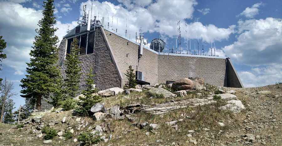
What’s at the Summit of Starr Peak?
The summit features a large rooftop antenna structure built by American Tower, known as ATC Thorodin – 90369. In the past, the peak was home to a 40-foot steel tower, constructed in 1941 and dismantled in 1996.
How Long Is the Road to Starr Peak?
The road to the summit is completely unpaved and rocky. Only 4x4 vehicles can handle the steep and rough terrain. The ascent begins at Thorodin Drive and spans 2.39 km (1.48 miles), with an elevation gain of 369 meters. The average gradient is 15.43%, making it an incredibly steep climb.
Is the Road to Starr Peak Open in Winter?
Set high in the Thorodin Mountain Range, the road is only accessible during the summer months.
Pic: acb8268