How dangerous is the 4x4 road to Buena Vista Peak in Colorado?
Buena Vista Peak is a high mountain summit reaching an elevation of 2,614m (8,575ft) above sea level in Moffat County, Colorado. Tucked away in the northwestern corner of the Dinosaur National Monument, the road to the top is a primitive and punishing track that stays far away from the paved tourist loops. This is a high-altitude drive over the Douglas Mountain plateau where the main threats are not just the steep drops, but a unique type of clay mud that can paralyze even the most advanced 4x4 vehicles in minutes.
| Road facts: Buena Vista Peak | |
|---|---|
| Location | Dinosaur National Monument, Colorado (USA) |
| Elevation | 2,614 m (8,575 ft) |
| Length | 9.6 km (5.96 miles) from Harpers Corner Rd |
| Surface | Primitive Gravel / Clay Mud (Gumbo) |
| Vehicle Required | High-Clearance 4x4 mandatory |
How long is the 4x4 track to Buena Vista Peak?
The road to the summit spans 9.6 km (5.96 miles), starting as a turn-off from the paved Harpers Corner Road. While it is often overshadowed by the nearby road to Zenobia Peak, this track is arguably more primitive. The 9.6 km climb is slow-going, winding through rugged canyons carved by the Green and Yampa Rivers. It is a "shelf road" in several sections, meaning the track is carved directly into the cliffside with significant exposure and no guardrails. One wrong move on the loose gravel or a lapse in concentration on the narrowest bends can be fatal.
Why is the "Gumbo" mud on Buena Vista Peak so dangerous?
The biggest hazard for drivers on Buena Vista Peak is the soil composition. The dirt track contains a high concentration of bentonite clay, known locally as "gumbo." When dry, the road is a rough, rocky drive, but the moment a summer thunderstorm hits, the surface turns into a thick, grease-like paste. This mud clings to tires, filling the tread until they become smooth slicks, making steering and braking impossible. Even a heavy-duty 4x4 will slide sideways toward the cliff edges in these conditions. If rain is even a remote possibility, you must stay off this road; getting stuck on the plateau during a storm is a guaranteed survival situation.
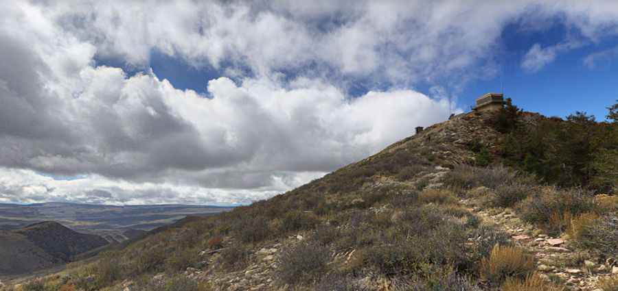
What are the technical challenges of the summit climb?
The final approach to the 2,614m summit is steep and rocky. The road has not been maintained for standard vehicles, and high ground clearance is essential to clear the embedded boulders and deep ruts. At the top stands a historic fire lookout tower built in 1964, which is a lightning magnet during the frequent afternoon storms that hit Moffat County. Beyond the mechanical strain on your engine from the high-altitude climb, you must also manage the "Round Top Mountain" section, where the track narrows to the width of a single vehicle with nowhere to turn around for several miles.
When is the road to Buena Vista Peak impassable?
The route is strictly seasonal and is typically buried under heavy snow from late October until June. Even in the summer months, the road is a high-risk drive. The Douglas Mountain plateau is one of the most remote areas in Colorado, meaning there is no cell service and roadside assistance is non-existent. Before leaving Harpers Corner Road, you must carry a full recovery kit, extra water, and a way to communicate without a phone. If you encounter lightning or heavy rain while near the lookout, the only safe protocol is to descend immediately before the "gumbo" mud turns the 9.6 km track into an impassable trap.
Pic: J H