Driving the challenging road to Mount Princeton in Colorado's Rocky Mountains
Mount Princeton is a high mountain peak at an elevation of 3,699 meters (12,137 feet) above sea level, located in Chaffee County, in the U.S. state of Colorado. It’s one of the highest roads in Colorado.
Why is it called Mount Princeton?
The mountain was named in honor of Princeton University.
Where is Mount Princeton?
The peak is located in the central part of Colorado, within the San Isabel National Forest.
Can I drive my passenger vehicle to Mount Princeton?
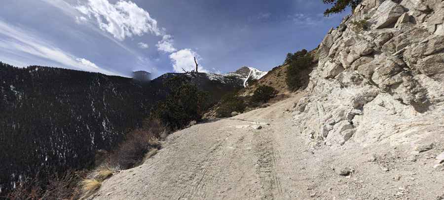
The road to the summit is totally unpaved and quite narrow. It’s called Forest Service Road 322A (Mount Princeton Road). Most of the trail at the lower elevations is extremely smooth and easy enough for a passenger car. It is only the last half mile or so that is really challenging, and a 4x4 vehicle is required. Most stock, high-clearance 4x4 SUVs can do it. Passenger vehicles should park down at the Young Life Camp and hike the road.
How long is the road to Mount Princeton?
The road to the summit is 9.97 km (6.2 miles) long, starting at the paved County Road 321. Over this distance, the elevation gain is 1,073 meters. The average gradient is 10.76%. It hits a maximum gradient of 14% through some of the ramps.
Is Mount Princeton open?
Set high in the Sawatch Range of the Rocky Mountains, winter comes early and stays late on this trail, so you may only be able to safely run it in the middle of the summer. This road is closed by snow from November through June, and snow may block the trail at the top as late as June or July.
Is Mount Princeton worth the drive?
The top has plenty of room for parking, and the views are amazing. The road ends at an old weather station and the Bristlecone Park Chalet, a little cabin.
Pic: Riley Cobb