The outstanding 4x4 road to Bill Moore Lake in Colorado
Bill Moore Lake is a beautiful alpine lake at an elevation of 3,465m (11,368ft) above sea level, located in Clear Creek County, in the US state of Colorado.
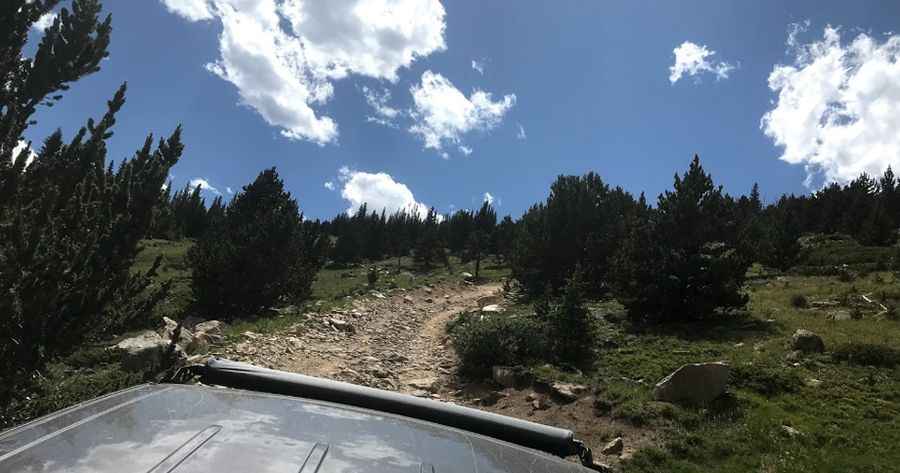
Is the road to Bill Moore Lake in Colorado unpaved?
The road to the lake is totally unpaved, very rocky and steep. It’s called Forest Service Road 183.1. It’s a very scenic route to a high mountain lake. There is a long climb near the end with loose dirt and small rocks. It may be too challenging for some stock SUVs and may be impossible if it is wet. A 4-wheel drive, high-clearance vehicle is highly recommended.
How long is the road to Bill Moore Lake in Colorado?
Starting from the historic Town of Empire, the road is 9.79km (6.08 miles) long. The road is pretty steep. Over this distance, the elevation gain is 833 meters. The average gradient is 8.50%.
Is the road to Bill Moore Lake in Colorado open?
Set high in the Arapaho National Forest and surrounded by groves of aspen and pine, the road to the gorgeous alpine lake is seasonally closed during winter. Due to high elevation, the area is not generally snow-free until late June or even July in some years. Best traveled from late spring through fall.
Is the road to Bill Moore Lake in Colorado worth it?
Located on the eastern edge of the James Peak Wilderness Area, this is a long and bumpy trail, but the scenery is worth the trip. Most of the road is a shelf road through a rather dense pine forest. There is a fairly large parking lot at the end of the trail. It’s a great place to spend a weekend exploring a network of trails and historical sites, including the well-preserved Conqueror Mine.
Pic: Todd Johnson