Ultimate 4WD Destination: Hurricane Basin in Colorado
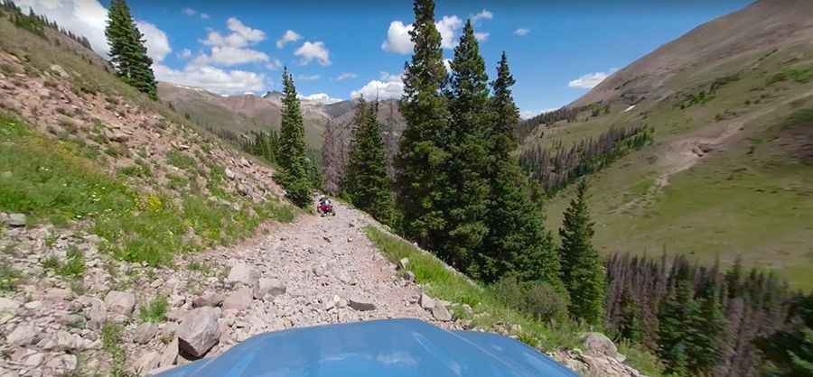
Hurricane Basin is a beautiful basin at an elevation of 3,776m (12,388ft) above sea level, located in Hinsdale County, in the U.S. state of Colorado. The trail is a bit rocky, and in some sections it is narrow with a severe drop-off to one side. It's one of the highest roads in Colorado.
Where is Hurricane Basin?
The basin is located east of Ouray, in the central part of Colorado, near the iconic Engineer Pass.
What's at the Summit of Hurricane Basin?
A group of historical buildings on an old mining complex are at the summit. It hosts the Golconda Boarding House and Compressor House, two buildings unlike any other. The mine produced gold, silver, lead, zinc, and copper. Structures were stabilized in 2014, and some portions were completely rebuilt.
Is the Road to Hurricane Basin Unpaved?
The rough road to the summit is totally unpaved and pretty rocky. It's called County Road 21. It is maintained by Hinsdale County and is usually graded every few years. It's really steep, hitting a 22% maximum gradient through some of the ramps. A high-clearance 4WD vehicle capable of handling the extreme terrain is required.
How long is the Road to Hurricane Basin?
Starting at Million Dollar Highway, the road is 16.89 km (10.5 miles) long. Beyond the little museum, the road continues higher to a remote location where the trail ends, at 3,858m (12,657ft) above sea level.
Is the Road to Hurricane Basin Open in Winter?
Set high in the Rocky Mountains of Colorado, this road is usually impassable from late October through late June or early July (depending on snow).
Is the Road to Hurricane Basin Worth the Drive?
The drive offers gorgeous views. This trail is highly recommended if you enjoy old mining buildings and high mountain views. The view is extraordinary from the top of the hill, and you can see several waterfalls too.
Pic: Trail Sections