Dare to drive the unpaved road to Kingston Peak in Colorado
Kingston Peak is a high mountain peak at an elevation of 3.671m (12,043ft) above sea level, located in the US state of Colorado. It’s one of the highest roads of Colorado.
Where is Kingston Peak?
The peak is located about an hour outside of Denver, on the boundary between Clear Creek and Gilpin counties, in the central part of Colorado, within the Arapaho and Roosevelt National Forests.
Is the road Kingston Peak in Colorado unpaved?
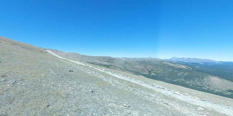
The road to the summit, known as FSR 353 1 (Kingston Peak road), is fully unpaved. A significant portion of this route lies above the timberline and can be steep and rocky in places. It's recommended for high clearance vehicles with 4WD only. While many SUVs might find the road challenging, a 4-wheel drive vehicle with good clearance should handle it well.
How long is the road to Kingston Peak in Colorado?
The road is 25.42km (15.8 miles) long, running from Rollinsville (in Gilpin County) to St. Mary's (in Clear Creek County).
Is the road to Kingston Peak in Colorado worth the drive?
The drive offers breathtaking views. Expect to see splendid vistas of the Continental Divide, Loch Lomond, and James Peak, which stands at 13,294 ft.
Is Kingston Peak in Colorado open?
Set high in the Front Range of the Rocky Mountains of North America, the road isn't plowed during winter. Remember the area is typically cold and windy. The route ascends above 12,000 feet, where snow can remain well into July. Early snowfalls can also close the upper sections of the trail as soon as mid-September.
Pic: Trevor Stone (Stonebeard)