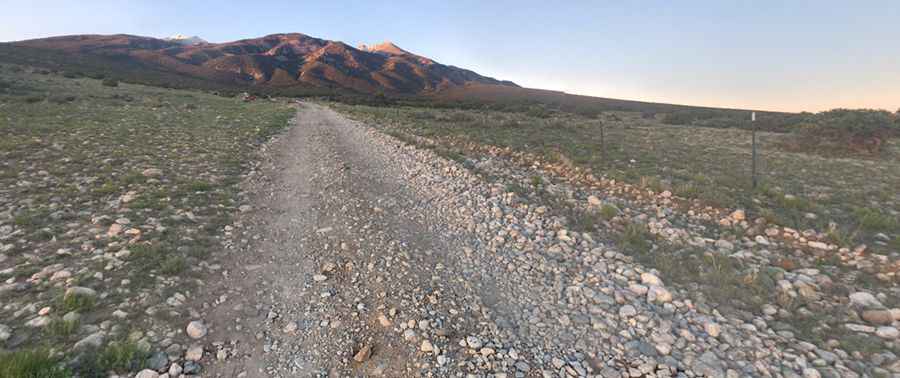
Lake Como is said to be Colorado's roughest road
Lake Como is a high mountain lake at an elevation of 3,586m (11,765ft) above sea level, located in Alamosa County, in the U.S. state of Colorado. It’s one of the highest roads in Colorado.

Where is Lake Como?
The lake is located very near Alamosa and the Great Sand Dunes, in the southern part of Colorado, to the west of Blanca Peak.
Can you drive to Lake Como in Colorado?
The road to the summit is totally unpaved. It’s called Lake Como Road (Blanca Peak Road).
How long is the road to Lake Como?
Starting at the paved CO-150, the road to the lake is 12km (7.45 miles) long. East of the lake, a minor gravel 4x4 road climbs up to Blue Lakes, at 3,711m (12,175ft) ASL.
Is the road to Lake Como open?
Set high in the Sangre de Cristo Mountains, the road is usually impassable from late October through late June or early July (depending on snow). The weather in this area is subject to sudden changes, and thunderstorms can be expected at any time.
Is the road to Lake Como challenging?
It’s a very challenging drive, extremely rough, and made mostly of loose boulders. It’s said to be one of Colorado's roughest roads. It gets much more difficult above 10,000'. 4x4 vehicles with high clearance only. Your concern for the car will determine where you want to park. It's tough on the ankles on all rock sections. This trail should never be driven alone. Make sure you and your vehicle are prepared before attempting it. The first 4.5 miles of the Blanca Peak Trail are over an extremely rough, rocky jeep road. A very specialized four-wheel-drive vehicle is required to climb this road. The challenge or severity of the Lake Como Road is such that many people travel from distant parts of the country with their modified 4WD vehicles just to drive up this road. It’s a very steep drive, hitting a 26% maximum gradient through some of the ramps.
Pic: Jeremy Glik