How to drive the defiant unpaved road to Eagle Rock in California?
Eagle Rock is a mountain peak at an elevation of 760 m (2,493 ft) above sea level, located in Santa Cruz County, in the U.S. state of California.
Where is Eagle Rock in California?
The summit, also known as Eagle Peak, Eagle Rock Peak, or Campbell Peak, is located west of Redwood Grove, on the Pacific coast, in the central part of California. The area can bake in the summer and freeze in the winter, so be aware.
What’s at the summit of Eagle Rock in California?
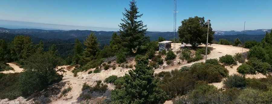
Set high in the Santa Cruz Mountains, the summit hosted a fire lookout built in 1934 by the CCC. It was badly vandalized and finally burned to the ground on August 4, 2018. Once you reach the summit, there is a small trail that leads to the summit platform. The side of the rock is a 100-foot sheer face, so be cautious. The summit offers great views of Mt. Umunhum, Loma Prieta, Santa Lucia Range, and the Santa Cruz Mountains.
How long is the road to Eagle Rock in California?
The road to the summit is totally unpaved. 4WD vehicles required. It’s a very steep drive, hitting an 11% maximum gradient on some of the ramps. Starting at the paved Empire Grade Road, the ascent is 1 km (0.62 miles) long. Over this distance, the elevation gain is 70 meters, and the average gradient is 7%.
Pic: Brett Sutton