How to get by car to Black Mesa in Colorado
Black Mesa is a high mountain at an elevation of 3,427 m (11,243 ft) above sea level, located in Dolores County, in the U.S. state of Colorado.
Where is Black Mesa in Colorado?
The prominent mesa is located within the southwestern part of Colorado. It is part of the larger Mesa de Maya formation, which extends into New Mexico and Oklahoma. This high mountain is often confused with the Black Mesa of Oklahoma (the state high point), which is a different geological feature.
Why is Black Mesa in Colorado famous?
Black Mesa is characterized by its flat-topped summit and steep sides, typical of mesa formations. These landforms are the result of erosion processes that have worn away the surrounding softer rock layers, leaving the more resistant layers intact.
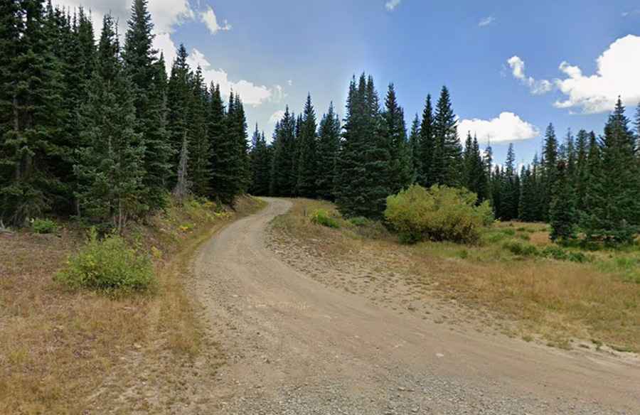
Is the road to Black Mesa in Colorado unpaved?
The road to the summit is totally unpaved. It’s called Forest Service Road 452 (FR 452). A 4x4 vehicle is required. Starting from Road 52, the road is 3.21 km (2.0 miles) long.
Is the road to Black Mesa in Colorado open in winter?
Set high in the San Miguel Mountains range of the Rocky Mountains, the road to the summit is typically open from May to October. During the winter months, from late October to early May, the road is inaccessible due to deep snow.