FR123 is a wild road in the Tushar Mountains of Utah
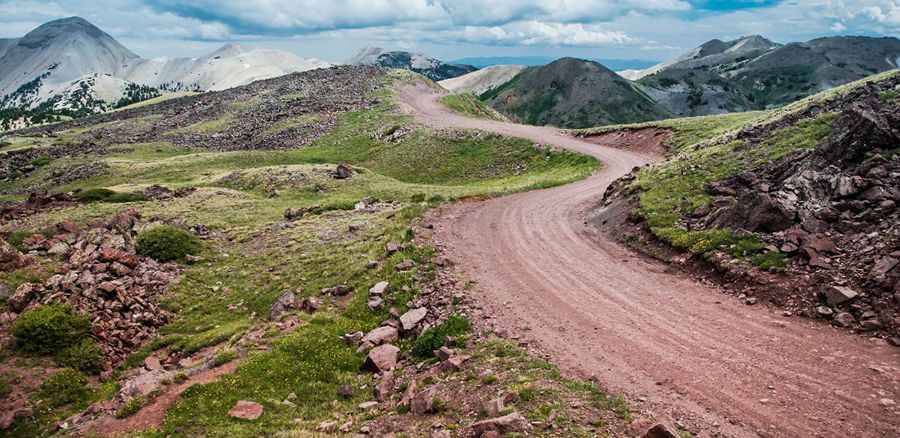
Forest Road 123 (FR123) is a highly challenging high mountain drive located in Piute County, in the US state of Utah. It's one of the highest roads in Utah, topping out at 3,503m (11,492ft) above sea level.
Why is it called Tushar Mountains?
The name "Tushar" comes from an ancient Indian or Hindu word meaning "snow," something that the Tushars receive a lot of.
Where is Forest Road 123 in Utah?
The road is located within Fishlake National Forest, in the Tushar Mountains of south-central Utah. The Tushars are the third-highest mountain range in Utah (behind the Uinta and the La Sal mountain ranges).
How long is Forest Road 123 in Utah?
The road, also known as Big John Flat Road, is 25.42km (15.8 miles) long. The unpaved winding road is narrow and steep past Big John Flat and is not recommended for travel trailers. It runs north-south from North Beaver Creek Road to paved highway SR-173 near Elk Meadows Ski Resort and Puffer Lake. The drive is pretty remote, with no cell phone reception. 4WD, high-clearance vehicle required. Risk of falling rocks.
Is Forest Road 123 in Utah open?
The road runs entirely above 2,600 meters above sea level. Forest Road #123 is not plowed during the winter. Please stay on the trail, as both sides of the road over the top are closed year-round to any motorized form of travel.
Is FR123 in the Tushar Mountains worth it?
Along this scenic and twisty road, keep looking for wildlife: turkeys, ground squirrels, chipmunks, deer, and elk, just to name a few. The Tushars offer stunning vistas, palpable solitude, and nearly unlimited opportunities for unconfined recreation.
Pic: Shane Bezzant