Travel Guide to the Top of Abajo Peak in Utah
Abajo Peak is a high mountain peak at an elevation of 3,450m (11,318ft) above sea level, located in San Juan County, in the U.S. state of Utah. It’s one of the highest roads in Utah.
Where is Abajo Peak?
The peak is located in the southeastern portion of Utah, near the Colorado border, within the Manti-La Sal National Forest.
What’s at the Summit of Abajo Peak in Utah?
The summit hosts many communication towers and facilities.
How Long is the Road to Abajo Peak in Utah?
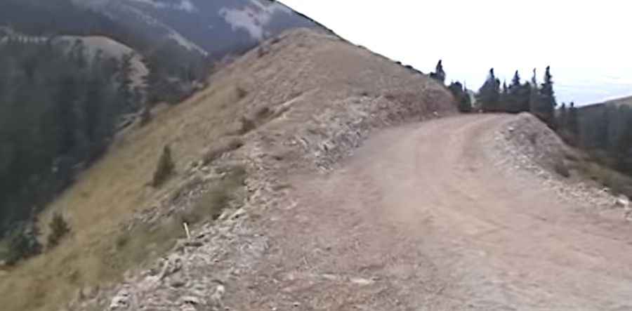
The road to the summit is totally unpaved. It’s called Forest Road 0087 (Abajo Peak Road). Starting from Monticello, the road is 20.43km (12.7 miles) long. Over this distance, the elevation gain is 1,279 meters. The average gradient is 6.26%. This is mostly a good road and is only really rough at the very end. A 4x4 vehicle is required.
Is the Road to Abajo Peak in Utah Open in Winter?
Set high in the Abajo Mountains, often referred to as the Blue Mountains by locals, the road to the summit is usually open from late June through sometime in October.
Is the Road to Abajo Peak in Utah Worth the Drive?
The views at the summit are spectacular, so it’s definitely worth driving up there. The summit provides a panoramic view of southeastern Utah, Colorado, and the Four Corners region, where Utah, Arizona, Colorado, and New Mexico meet.
Pic&video: Raevets