How to drive the difficult road to Star Point in Utah
Star Point is a high mountain pass at an elevation of 3.067m (10,062ft) above sea level located in the Carbon County, in the US state of Utah.
Where is Star Point in Utah?
The pass is located west of Price in the north-central part of Utah.
How long is the road to Star Point in Utah?
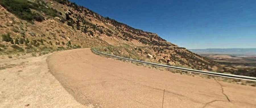
The road to the summit is called Star Point Mine Road. Starting from UT-10, the road to the summit is 32.18km (20.0 miles) long. Over this distance, the elevation gain is 1363m (4,472 ft) and the average gradient is 4.23%. The drive is not easy, with countless curves, 4 sharp hairpin turns and steep parts.
Is the road to Star Point in Utah unpaved?
The road to the summit comprises both paved and unpaved sections. The first 14 miles are totally paved, and the final 6 miles are unpaved. A 4x4 vehicle is required to complete the drive.
Is the road to Star Point in Utah open year-round?
At this elevation the road is totally impassable in winters.