Travel Guide to the Top of Brian Head Peak in Utah
Brian Head Peak is a high mountain peak at an elevation of 3,450 m (11,318 ft) above sea level, located in Iron County, in the US state of Utah. It’s one of the highest roads in Utah.
Where is Brian Head Peak?
The peak, known as Monument Peak until 1890, is located north of Cedar Breaks National Monument in Dixie National Forest, in the southwestern part of Utah. The high elevation can make some people feel very dizzy when making fast movements or standing up.
What’s at the Summit of Brian Head Peak?
At the summit, there’s a Forest Service lookout built in 1934-1935 by the Civilian Conservation Corps Camp F-16, stationed at Duck Creek. From the summit, you can see parts of Utah, Nevada, and Arizona.
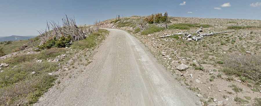
Is the Road to Brian Head Peak Unpaved?
The road to the summit is a good dirt road called Forest Road 047. The road is a little rough but accessible by passenger vehicles. Make sure you have great off-road tires, as there are no railings. This road was built using a small caterpillar and horse-drawn equipment. Be very careful, as there are sheer drops.
How Long is the Road to Brian Head Peak?
The road is steep. Starting from the paved UT-143, the road is 4.34 km (2.7 miles) long. Over this distance, the elevation gain is 269 meters, and the average gradient is 6.19%.
Is the Road to Brian Head Peak Open in Winter?
The road to the summit is usually open from around late June through sometime in October.