The road to Difficult Pass in Colorado is not for the inexperienced
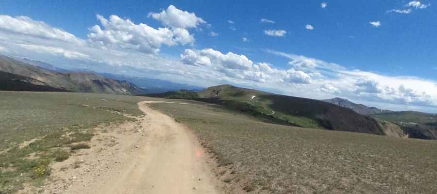
Difficult Pass is a high mountain pass at an elevation of 3,712m (12,178ft) above sea level, located in the U.S. state of Colorado. It’s one of the highest roads in Colorado.
Where is Difficult Pass?
The pass is located on the boundary between Gunnison and Pitkin counties, in the central part of Colorado, within the Gunnison National Forest.
How long is the road through Difficult Pass?
The road to the summit is totally unpaved. It is called Richmond Hill Road. 4x4 vehicles with high clearance only. The road is 2.41km (1.5 miles) long, running south–north from Richmond Hill Road to Goodwin-Greene hut.
What’s the history of Goodwin-Greene hut?
Built in 1976, it holds the reputation for being one of the most remote and difficult huts to find. The hut was named in memory of Peter Goodwin and Carl Greene, who passed away in a climbing accident.
Is the road to Difficult Pass open in winter?
Set high in the Elk Range of Colorado’s Rocky Mountains, the road is impassable from October to July. July may still be snowed in, and October’s early snows may close the pass. It’s an area of known avalanche terrain with recurring avalanche cycles.
Pic: Master T